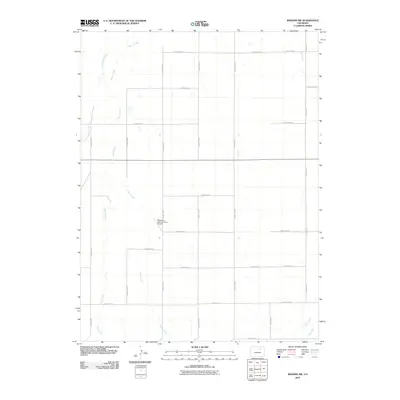
2010 Map of Wiggins SW
USGS Topo · Published 2010About this map
Kiowa Creek and several other ephemeral drainage paths define this landscape in eastern Colorado, where the high plains terrain is partitioned by an orderly grid of rural roads. The area is dominated by agricultural development, evidenced by the central location of the Westberg-Rosling Farms Airport, a private facility serving local aviation needs. Water management is a critical component of this semi-arid environment, highlighted by the presence of the Nile Ditch in the southeastern corner, which redirects flow from Rock Creek to support regional farming. The map traces the winding courses of Jack Rabbit Creek, Goose Creek, and Mule Creek, illustrating how these natural waterways interact with a dense network of county thoroughfares like County Rd-18 and County Rd-1.
Find a feature on this map
29 named features on this map. Tap any name to fly to it.
Don’t see what you’re looking for? This feature index may not catch every label — zoom into the map to look around manually.
Map Details
Editions of this 2010 Wiggins SW Map
This is the sole edition of this map. No revisions or reprints were ever made.
Other maps of this area

1950 · Wiggins
USGS Topo · 1:24,000

1950 · South Roggen
USGS Topo · 1:24,000

1950 · Wiggins SW
USGS Topo · 1:24,000

1950 · Hoyt
USGS Topo · 1:24,000

1951 · Hoyt
USGS Topo · 1:24,000

1951 · Living Springs
USGS Topo · 1:24,000

1951 · Roggen
USGS Topo · 1:24,000

1951 · Leader NW
USGS Topo · 1:24,000

1951 · Omar
USGS Topo · 1:24,000

1951 · Leader
USGS Topo · 1:24,000