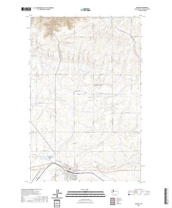
1989 Map of Wilbur
USGS Topo · Published 1989About this map
Wilbur serves as the primary hub of this eastern Washington landscape, situated along the banks of Goose Creek. The late-century town layout includes essential community infrastructure like the Wilbur Airport, a Golf Course, and local Gravel Pits that suggest a reliance on local materials for regional development. Beyond the town limits, the terrain is defined by dry drainage features such as Sage Hen Draw and Corbett Draw, which carve through the plateau. A Cem on the outskirts of town and the small settlement of Johnson to the north provide specific points of interest for genealogists tracking family roots in Lincoln County. The presence of several Steel Tower Trans Lines and wooden pole lines cutting across the wheat-growing country highlights the region's role in the power transmission network of the Pacific Northwest during the late 1980s.
Find a feature on this map
20 named features on this map. Tap any name to fly to it.
Don’t see what you’re looking for? This feature index may not catch every label — zoom into the map to look around manually.
Map Details
Editions of this 1989 Wilbur Map
This is the sole edition of this map. No revisions or reprints were ever made.
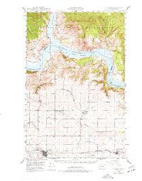
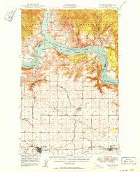
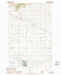
Historical Maps of Wilbur Through Time
4 maps found