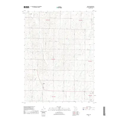
2017 Map of Wilcox
USGS Topo · Published 2017About this map
The settlement of Wilcox serves as the focal point for this survey of rural Nodaway County, situated along a section of US Highway 71 and 136. The landscape is defined by its extensive drainage network, including the waters of White Cloud Cr, S Fork Clear Cr, and the slow-moving Big Slough. This network of creeks and sloughs created a fertile, rolling environment that supported early agricultural development in Polk Township. Researchers will find the Wilcox Cem located just west of the main village, providing a key site for local genealogical study. To the north, the small community area of Toad Hollow sits along State Hwy B, reflecting the pattern of small-scale rural hamlets that once peppered this part of Missouri. The map preserves the exact alignment of historical section lines and county roads, such as Glacier Rd and Hallmark Rd, which continue to organize the regional geography.
Find a feature on this map
49 named features on this map. Tap any name to fly to it.
Don’t see what you’re looking for? This feature index may not catch every label — zoom into the map to look around manually.
Map Details
Editions of this 2017 Wilcox Map
This is the sole edition of this map. No revisions or reprints were ever made.
Other maps of this area

1939 · Skidmore
USGS Topo · 1:62,500

1940 · Coin
USGS Topo · 1:62,500

1940 · New Market
USGS Topo · 1:62,500

1941 · Skidmore
USGS Topo · 1:62,500

1942 · Skidmore
USGS Topo · 1:62,500

1943 · Coin
USGS Topo · 1:62,500

1943 · Maryville
USGS Topo · 1:62,500

1943 · New Market
USGS Topo · 1:62,500

1955 · Nebraska City
USGS Topo · 1:250,000

1957 · Nebraska City
USGS Topo · 1:250,000