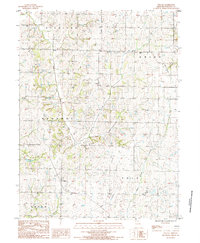
1985 Map of Wilcox
USGS Topo · Published 1985About this map
Wilcox serves as the central hub of this Missouri landscape, situated within a patchwork of agricultural lands and meandering waterways in Nodaway County. The drainage patterns of the region are clearly defined by the Clear Fork and White Cloud Creek, which cut through the terrain alongside smaller tributaries like Muddy Cr and Sand Cr. This 1980s-era documentation highlights the rural infrastructure of the period, from the localized utility of the Landing Strip to the residential pocket of the Trailer Park near the eastern boundary.
Find a feature on this map
15 named features on this map. Tap any name to fly to it.
Don’t see what you’re looking for? This feature index may not catch every label — zoom into the map to look around manually.
Map Details
Editions of this 1985 Wilcox Map
This is the sole edition of this map. No revisions or reprints were ever made.
Other maps of this area

1939 · Skidmore
USGS Topo · 1:62,500

1940 · Coin
USGS Topo · 1:62,500

1940 · New Market
USGS Topo · 1:62,500

1941 · Skidmore
USGS Topo · 1:62,500

1942 · Skidmore
USGS Topo · 1:62,500

1943 · Coin
USGS Topo · 1:62,500

1943 · Maryville
USGS Topo · 1:62,500

1943 · New Market
USGS Topo · 1:62,500

1955 · Nebraska City
USGS Topo · 1:250,000

1957 · Nebraska City
USGS Topo · 1:250,000