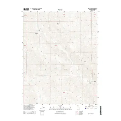
2015 Map of Wilcox Ridge
USGS Topo · Published 2015About this map
Wilcox Ridge anchors this landscape in the Diablo Range of Stanislaus County, where a complex network of canyons and peaks defines the watershed of Orestimba Cr. This 2015 survey shows a terrain carved by seasonal waterways like Sheep Thief Cr and Salado Cr, suggesting a long history of cattle grazing and land use in the California Coast Ranges. The topography is punctuated by named landmarks such as Mikes Peak and the passage at Days Pass. The map reveals the intricate drainage patterns of the N Fork Orestimba Cr and its many tributaries, including Robison Cr. Historical land management is evident in the detailed canyon names like Gooseberry Canyon and Lion Canyon, as well as the unique geological formation at the Orestimba Narrows near the southern boundary.
Find a feature on this map
26 named features on this map. Tap any name to fly to it.
Don’t see what you’re looking for? This feature index may not catch every label — zoom into the map to look around manually.
Map Details
Editions of this 2015 Wilcox Ridge Map
This is the sole edition of this map. No revisions or reprints were ever made.
Other maps of this area

1916 · Patterson
USGS Topo · 1:31,680

1919 · Orestimba
USGS Topo · 1:62,500

1919 · Orestimba Creek
USGS Topo · 1:31,680

1920 · Pacheco Pass
USGS Topo · 1:62,500

1921 · Gilroy Hot Springs
USGS Topo · 1:62,500

1938 · Mt. Boardman
USGS Topo · 1:62,500

1939 · Gilroy Hot Springs
USGS Topo · 1:62,500

1940 · Gilroy Hot Springs
USGS Topo · 1:62,500

1940 · Pacheco Pass
USGS Topo · 1:62,500

1941 · Orestimba
USGS Topo · 1:62,500