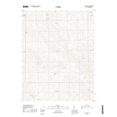
2018 Map of Wilcox Ridge
USGS Topo · Published 2018About this map
The Diablo Range dominates this portion of Stanislaus County, where the landscape is defined by a dense network of canyons and ridges. Modern transit through the area is limited to rugged corridors like Upper Oak Flat Rd, while more remote reaches are accessible only via historic paths such as the Murphy Trl and the Rooster Comb Trl. Water drains through complex systems including N Fork Orestimba Cr and its tributaries, Sheep Thief Cr and Robison Cr. Significant topographical markers like Mikes Peak and Wilcox Ridge provide orientation across a territory punctuated by distinct natural flats and passes, including Jackass Flat and Days Pass. This 2018 survey represents the contemporary management of this undeveloped California backcountry, preserving the nomenclature of 19th-century livestock grazing and frontier travel.
Find a feature on this map
30 named features on this map. Tap any name to fly to it.
Don’t see what you’re looking for? This feature index may not catch every label — zoom into the map to look around manually.
Map Details
Editions of this 2018 Wilcox Ridge Map
This is the sole edition of this map. No revisions or reprints were ever made.
Other maps of this area

1916 · Patterson
USGS Topo · 1:31,680

1919 · Orestimba
USGS Topo · 1:62,500

1919 · Orestimba Creek
USGS Topo · 1:31,680

1920 · Pacheco Pass
USGS Topo · 1:62,500

1921 · Gilroy Hot Springs
USGS Topo · 1:62,500

1938 · Mt. Boardman
USGS Topo · 1:62,500

1939 · Gilroy Hot Springs
USGS Topo · 1:62,500

1940 · Gilroy Hot Springs
USGS Topo · 1:62,500

1940 · Pacheco Pass
USGS Topo · 1:62,500

1941 · Orestimba
USGS Topo · 1:62,500