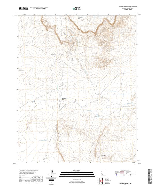
2021 Map of Wild Band Pockets
USGS Topo · Published 2021About this map
Yellowstone Spring serves as a vital water source in this high desert environment of Mohave County, where the landscape is defined by its seasonal drainages and topographic relief. The terrain transitions from the elevated Yellowstone Mesa in the north down through the expansive Wild Band Valley. Water management is evident through features like Sims Reservoir and Bundy Ponds, which suggest cattle ranching or land management practices in an area otherwise dominated by dry washes like Bulrush Wash and Yellowstone Wash.
Find a feature on this map
19 named features on this map. Tap any name to fly to it.
Don’t see what you’re looking for? This feature index may not catch every label — zoom into the map to look around manually.
Map Details
Editions of this 2021 Wild Band Pockets Map
This is the sole edition of this map. No revisions or reprints were ever made.
Other maps of this area

1886 · Mt. Trumbull
USGS Topo · 1:250,000

1886 · Kaibab
USGS Topo · 1:250,000

1892 · Mt. Trumbull
USGS Topo · 1:250,000

1953 · Grand Canyon
USGS Topo · 1:250,000

1954 · Heaton Knolls NW
USGS Topo · 1:24,000

1954 · Lost Spring SE
USGS Topo · 1:24,000
1954 · Short Creek SW
USGS Topo · 1:24,000

1954 · Short Creek SE
USGS Topo · 1:24,000

1954 · Heaton Knolls SE
USGS Topo · 1:24,000
1954 · Lost Spring Mtn
USGS Topo · 1:62,500