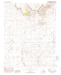
1988 Map of Wild Band Pockets
USGS Topo · Published 1988About this map
Yellowstone Mesa dominates the northern horizon of this high desert terrain in Mohave County, where water management is the primary evidence of human presence in the late 1980s. The landscape is defined by the broad Antelope Valley and Wild Band Valley, separated by the prominent Little Hurricane Ridge. Ranching infrastructure is sparse but essential, marked by several Check Dams, a Corral, and reliable water points like Yellowstone Spring, Sims Reservoir, and Bundy Ponds. Along the Yellowstone Wash, the named Wild Band Pockets suggest natural catchments in an otherwise arid expanse. Small-scale industrial activity is limited to a single Gravel Pit and a remote Prospect, reflecting the area's isolated and utilitarian character during this era of U.S. Geological Survey mapping.
Find a feature on this map
17 named features on this map. Tap any name to fly to it.
Don’t see what you’re looking for? This feature index may not catch every label — zoom into the map to look around manually.
Map Details
Editions of this 1988 Wild Band Pockets Map
This is the sole edition of this map. No revisions or reprints were ever made.
Other maps of this area

1886 · Mt. Trumbull
USGS Topo · 1:250,000

1886 · Kaibab
USGS Topo · 1:250,000

1892 · Mt. Trumbull
USGS Topo · 1:250,000

1953 · Grand Canyon
USGS Topo · 1:250,000

1954 · Heaton Knolls NW
USGS Topo · 1:24,000

1954 · Lost Spring SE
USGS Topo · 1:24,000
1954 · Short Creek SW
USGS Topo · 1:24,000

1954 · Short Creek SE
USGS Topo · 1:24,000

1954 · Heaton Knolls SE
USGS Topo · 1:24,000
1954 · Lost Spring Mtn
USGS Topo · 1:62,500