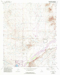
1973 Map of Wild Crossing
USGS Topo · Published 1993About this map
The Mojave River valley north of Victorville is defined here by a transition from traditional desert trails to modern planned developments. By the late 20th century, the master-planned community of Silver Lakes had begun to take shape around its Golf Course, while the nearby Wild Crossing and a local Mobile Home Park reflect the ongoing residential settlement of the High Desert. This landscape is a corridor of transportation history, where the National Trails Highway and the Atchison Topeka and Santa Fe railroad run parallel to the river. Further east, the terrain becomes more distinct with the prominent Point of Rocks and the desert expanses of Brisbane Valley. Evidence of earlier land use remains visible through various Mine and Prospect symbols on the slopes of Iron Mountain, while a network of named tracks like Wagonwheel Trail and Sagebrush Trail crisscross the southern washes.
Find a feature on this map
33 named features on this map. Tap any name to fly to it.
Don’t see what you’re looking for? This feature index may not catch every label — zoom into the map to look around manually.
Map Details
Editions of this 1973 Wild Crossing Map
2 editions found
Other maps of this area

1932 · Barstow
USGS Topo · 1:125,000

1934 · Barstow
USGS Topo · 1:125,000

1953 · San Bernardino
USGS Topo · 1:250,000

1956 · San Bernardino
USGS Topo · 1:250,000

1956 · Hawes
USGS Topo · 1:62,500
1956 · Victorville NW
USGS Topo · 1:24,000

1956 · Barstow
USGS Topo · 1:62,500

1956 · Helendale
USGS Topo · 1:24,000
1956 · Victorville
USGS Topo · 1:62,500

1957 · Apple Valley
USGS Topo · 1:62,500