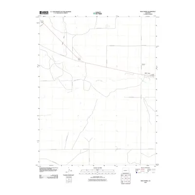
2010 Map of Wild Horse
USGS Topo · Published 2010About this map
Wild Horse stands as a primary landmark in this high plains region of Cheyenne County, situated along a network of vital rural transport corridors. The landscape is defined by the ephemeral path of Big Sandy Creek, which meanders through the central and western portions of the quadrangle, joined by the northern drainage of Adobe Gulch. This 2010 survey illustrates a characteristic Western grid system of maintained gravel routes, including County Road R and County Rd 8, which provide access to remote agricultural parcels and historical sites. For those researching local roots, the Wild Horse Cemetery remains a significant focal point for genealogical study, located just north of the town site. The map reflects the enduring, sparse settlement patterns of the Colorado plains, where watercourses and section roads dictate the movement and development of the community.
Find a feature on this map
15 named features on this map. Tap any name to fly to it.
Don’t see what you’re looking for? This feature index may not catch every label — zoom into the map to look around manually.
Map Details
Editions of this 2010 Wild Horse Map
This is the sole edition of this map. No revisions or reprints were ever made.
Other maps of this area

1891 · Arroyo
USGS Topo · 1:125,000

1891 · Kit Carson
USGS Topo · 1:125,000

1893 · Arroyo
USGS Topo · 1:125,000

1893 · Kit Carson
USGS Topo · 1:125,000

1954 · Lamar
USGS Topo · 1:250,000

1958 · Lamar
USGS Topo · 1:250,000

1978 · Galatea NE
USGS Topo · 1:24,000

1978 · Aroya
USGS Topo · 1:24,000

1978 · Sanders Ranch
USGS Topo · 1:24,000

1978 · Stacy Lakes Draw
USGS Topo · 1:24,000