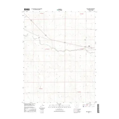
2016 Map of Wild Horse
USGS Topo · Published 2016About this map
Wild Horse and Aroya anchor this high plains landscape in eastern Colorado, where the settlement pattern follows the gentle path of Big Sandy Creek. The drainage of Adobe Gulch cuts through the western portion of the terrain, illustrating the gradual erosion characteristic of this arid region. Transportation across the territory is defined by a rectilinear grid of section roads, including Co Rd 8 and Co Rd M, which provide access to the vast ranching and agricultural plots divided by the Public Land Survey System. For genealogists and local historians, the Wild Horse Cem serves as a critical landmark for tracing early families who settled near the creek. The map reflects a moment in the mid-2010s where the infrastructure remains focused on these sparse, historically significant junctions.
Find a feature on this map
18 named features on this map. Tap any name to fly to it.
Don’t see what you’re looking for? This feature index may not catch every label — zoom into the map to look around manually.
Map Details
Editions of this 2016 Wild Horse Map
This is the sole edition of this map. No revisions or reprints were ever made.
Other maps of this area

1891 · Arroyo
USGS Topo · 1:125,000

1891 · Kit Carson
USGS Topo · 1:125,000

1893 · Arroyo
USGS Topo · 1:125,000

1893 · Kit Carson
USGS Topo · 1:125,000

1954 · Lamar
USGS Topo · 1:250,000

1958 · Lamar
USGS Topo · 1:250,000

1978 · Galatea NE
USGS Topo · 1:24,000

1978 · Aroya
USGS Topo · 1:24,000

1978 · Sanders Ranch
USGS Topo · 1:24,000

1978 · Stacy Lakes Draw
USGS Topo · 1:24,000