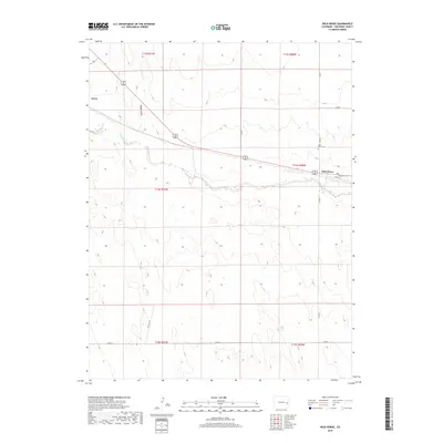
2019 Map of Wild Horse
USGS Topo · Published 2019About this map
Big Sandy Creek defines the lower drainage of this High Plains landscape, cutting a wide alluvial path through the eastern Colorado prairie. The settlement of Wild Horse sits at a strategic crossroads where local routes like Co RD 8 intersect the regional highway, supported by the nearby Wild Horse Cem. To the northwest, the small community of Aroya occupies the high ground above Adobe Gulch, showing the sparse, grid-dependent settlement patterns characteristic of Cheyenne County. This 2019 survey documents the enduring pastoral nature of the region, where the vast township and range system dictates the placement of section roads like Co RD M and Co RD T. The map reveals the persistence of these isolated ranching hubs and their vital water sources in an arid environment.
Find a feature on this map
17 named features on this map. Tap any name to fly to it.
Don’t see what you’re looking for? This feature index may not catch every label — zoom into the map to look around manually.
Map Details
Editions of this 2019 Wild Horse Map
This is the sole edition of this map. No revisions or reprints were ever made.
Other maps of this area

1891 · Arroyo
USGS Topo · 1:125,000

1891 · Kit Carson
USGS Topo · 1:125,000

1893 · Arroyo
USGS Topo · 1:125,000

1893 · Kit Carson
USGS Topo · 1:125,000

1954 · Lamar
USGS Topo · 1:250,000

1958 · Lamar
USGS Topo · 1:250,000

1978 · Galatea NE
USGS Topo · 1:24,000

1978 · Aroya
USGS Topo · 1:24,000

1978 · Sanders Ranch
USGS Topo · 1:24,000

1978 · Stacy Lakes Draw
USGS Topo · 1:24,000