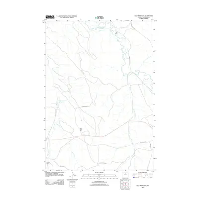
2012 Map of Wild Horse Hill
USGS Topo · Published 2012About this map
Wild Horse Hill rises as a central landmark in this high-plains landscape of Washakie County, where water management is the primary driver of development. The intricate network of irrigation is anchored by The West Ditch and the Victoria-Winsor Ditch, both drawing from the meandering course of the Nowood River. This 2012 survey illustrates a region where ranching and resource extraction routes define the human footprint, seen in the path of the W T Stock Driveway and the Bentonite Ridge Rd.
Find a feature on this map
19 named features on this map. Tap any name to fly to it.
Don’t see what you’re looking for? This feature index may not catch every label — zoom into the map to look around manually.
Map Details
Editions of this 2012 Wild Horse Hill Map
This is the sole edition of this map. No revisions or reprints were ever made.
Other maps of this area

1899 · Cloud peak
USGS Topo · 1:125,000

1901 · Cloud Peak
USGS Topo · 1:125,000

1955 · Sheridan
USGS Topo · 1:250,000

1955 · Arminto
USGS Topo · 1:250,000

1958 · Sheridan
USGS Topo · 1:250,000

1958 · Arminto
USGS Topo · 1:250,000

1962 · Sheridan
USGS Topo · 1:250,000

1962 · Arminto
USGS Topo · 1:250,000

1966 · Cabin Fork
USGS Topo · 1:24,000
1966 · Joe Emge Creek
USGS Topo · 1:24,000