
1951 Map of Wild Horse Lake
USGS Topo · Published 1952About this map
The Pawnee Hills rise over this Logan County landscape, where the seasonal waters of Wild Horse Lake and Dry Wild Horse Lake characterize the high plains drainage. Surveyed in the early 1950s as part of the Missouri River Basin development program, the map documents a transition from traditional dryland ranching to active petroleum extraction. The discovery of the Yenter Pool brought a network of oil wells, tanks, and improved roads to the area south of Graylin School. Despite this industrial expansion, the rural social fabric of the era remains visible through landmarks like Liberty School and numerous windmills scattered across the sections. The complex hydrology is marked by the courses of Wild Horse Creek, Pawnee Creek, and Sand Creek, while the triangulation point at VABM Johnson stands as a primary surveying benchmark for the region.
Find a feature on this map
14 named features on this map. Tap any name to fly to it.
Don’t see what you’re looking for? This feature index may not catch every label — zoom into the map to look around manually.
Map Details
Editions of this 1951 Wild Horse Lake Map
2 editions found
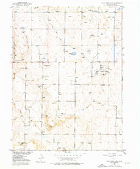
Other maps of this area

1951 · Willard
USGS Topo · 1:24,000

1951 · Atwood NE
USGS Topo · 1:24,000

1951 · Atwood
USGS Topo · 1:24,000

1954 · Sterling
USGS Topo · 1:250,000

1958 · Sterling
USGS Topo · 1:250,000

1977 · Stoneham NE
USGS Topo · 1:24,000

1977 · Avalo SE
USGS Topo · 1:24,000
1978 · North Sterling Reservoir
USGS Topo · 1:24,000
1978 · Stoneham SE
USGS Topo · 1:24,000
1978 · Westplains
USGS Topo · 1:24,000