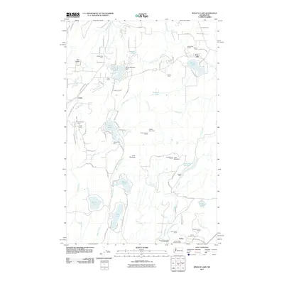
2011 Map of Wildcat Lake
USGS Topo · Published 2011About this map
Green Mountain and Gold Mountain dominate the central landscape of the Great Peninsula, serving as the high ground for a complex network of creeks and drainages. The Tahuya River, Mission Creek, and Big Beef Creek flow from these elevations, supporting numerous man-made and natural water bodies like Lake William Symington and Wildcat Lake. Small residential pockets and historical markers such as Crosby, Hite Center, and Camp Union dot the timbered terrain.
Find a feature on this map
98 named features on this map. Tap any name to fly to it.
Don’t see what you’re looking for? This feature index may not catch every label — zoom into the map to look around manually.
Map Details
Editions of this 2011 Wildcat Lake Map
This is the sole edition of this map. No revisions or reprints were ever made.
Other maps of this area

1936 · Point Misery
USGS Topo · 1:62,500

1937 · Port Orchard
USGS Topo · 1:62,500

1938 · Allyn
USGS Topo · 1:62,500

1940 · Point Misery
USGS Topo · 1:62,500

1942 · Gig Harbor
USGS Topo · 1:62,500

1943 · Gig Harbor
USGS Topo · 1:62,500

1953 · Seabeck
USGS Topo · 1:24,000

1953 · Poulsbo
USGS Topo · 1:24,000

1953 · Burley
USGS Topo · 1:24,000

1953 · Bremerton West
USGS Topo · 1:24,000