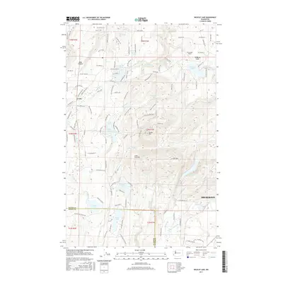
2017 Map of Wildcat Lake
USGS Topo · Published 2017About this map
Green Mountain and Gold Mountain dominate the central high ground of the Great Peninsula in this 2017 survey, a landscape defined by an intricate network of freshwater bodies and rising elevations west of Bremerton. This area of the Kitsap Peninsula serves as a critical watershed, with the Union River Reservoir and numerous high-elevation lakes including Wildcat Lake, Mission Lake, and Tiger Lake feeding the local drainage systems. The map illustrates the contemporary intersection of recreational aviation at Leisureland Airpark with rural residential patterns in Hite Center and Crosby.
Find a feature on this map
118 named features on this map. Tap any name to fly to it.
Don’t see what you’re looking for? This feature index may not catch every label — zoom into the map to look around manually.
Map Details
Editions of this 2017 Wildcat Lake Map
This is the sole edition of this map. No revisions or reprints were ever made.
Other maps of this area

1936 · Point Misery
USGS Topo · 1:62,500

1937 · Port Orchard
USGS Topo · 1:62,500

1938 · Allyn
USGS Topo · 1:62,500

1940 · Point Misery
USGS Topo · 1:62,500

1942 · Gig Harbor
USGS Topo · 1:62,500

1943 · Gig Harbor
USGS Topo · 1:62,500

1953 · Seabeck
USGS Topo · 1:24,000

1953 · Poulsbo
USGS Topo · 1:24,000

1953 · Burley
USGS Topo · 1:24,000

1953 · Bremerton West
USGS Topo · 1:24,000