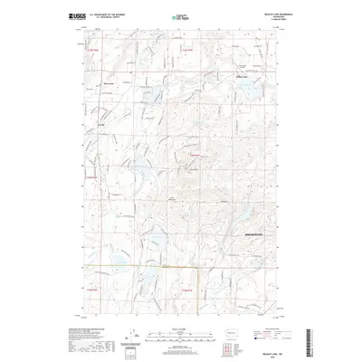
2020 Map of Wildcat Lake
USGS Topo · Published 2020About this map
Bremerton and the surrounding high ground of the Great Peninsula dominate this terrain on the Kitsap and Mason county line. The landscape is defined by a dense network of water bodies and elevated ridges, including Gold Mtn and Green Mtn. Between these heights, several significant lakes such as Wildcat Lake, Mission Lake, and Tahuya Lake form a recreational and residential core for local communities. The settlement pattern is characterized by scattered centers like Hite Center and Crosby, connected by a complex system of local roads and trails such as Boundary Trl NW and Redwing Trl NW. This network reflects the area's modern development as a residential and outdoor enclave. To the south, the Union River and its E Fork Union River drainage show the transition toward the lowlands near the coast, while the Leisureland Airpark highlights the area's specialized local infrastructure.
Find a feature on this map
124 named features on this map. Tap any name to fly to it.
Don’t see what you’re looking for? This feature index may not catch every label — zoom into the map to look around manually.
Map Details
Editions of this 2020 Wildcat Lake Map
This is the sole edition of this map. No revisions or reprints were ever made.
Other maps of this area

1936 · Point Misery
USGS Topo · 1:62,500

1937 · Port Orchard
USGS Topo · 1:62,500

1938 · Allyn
USGS Topo · 1:62,500

1940 · Point Misery
USGS Topo · 1:62,500

1942 · Gig Harbor
USGS Topo · 1:62,500

1943 · Gig Harbor
USGS Topo · 1:62,500

1953 · Seabeck
USGS Topo · 1:24,000

1953 · Poulsbo
USGS Topo · 1:24,000

1953 · Burley
USGS Topo · 1:24,000

1953 · Bremerton West
USGS Topo · 1:24,000