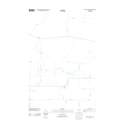
2013 Map of Wildcat Mound
USGS Topo · Published 2013About this map
Wildcat Mound rises as a prominent landmark in this section of Clark County, defining the local topography and drainage patterns. The landscape is deeply etched by a network of waterways including Fivemile Cr, Pony Cr, and Crooked Cr, which feed into larger systems like East Fork Halls Cr. This 2013 survey illustrates a sparsely settled rural area where the economy and movement are dictated by an extensive grid of local roads named for prominent families and geographical features, such as Walkers Rd, Van Kirk Rd, and Stuve Rd.
Find a feature on this map
35 named features on this map. Tap any name to fly to it.
Don’t see what you’re looking for? This feature index may not catch every label — zoom into the map to look around manually.
Map Details
Editions of this 2013 Wildcat Mound Map
This is the sole edition of this map. No revisions or reprints were ever made.
Other maps of this area

1924 · Black River Falls
USGS Topo · 1:62,500

1926 · Black River Falls
USGS Topo · 1:62,500

1948 · Fairchild
USGS Topo · 1:62,500

1949 · Fairchild
USGS Topo · 1:62,500

1953 · Neillsville
USGS Topo · 1:62,500

1953 · Eau Claire
USGS Topo · 1:250,000

1958 · Eau Claire
USGS Topo · 1:250,000

1958 · Hatfield
USGS Topo · 1:48,000

1964 · Eau Claire
USGS Topo · 1:250,000
1968 · Black River Falls
USGS Topo · 1:62,500