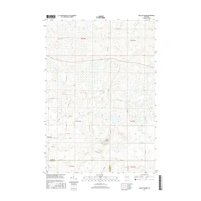
2015 Map of Wildcat Mound
USGS Topo · Published 2015About this map
Wildcat Mound dominates the central landscape of this western Wisconsin survey, rising above the intricate wetland networks that define the local geography. The settlement of Humbird sits at the southwestern edge of the map, serving as a gateway to the surrounding townships. The drainage of Fivemile Cr, Crooked Cr, and Pony Cr indicates a low-lying, water-saturated environment characteristic of this portion of the Clark Co and Jackson Co border. A dense grid of local roads, many named for local families such as Abbott Ranch Rd, Hickman Rd, and Gorman Ave, provides a detailed record of land ownership and rural development. The presence of Town Line Rd and Co Hwy B illustrates the administrative framework connecting these agricultural and timbered lands.
Find a feature on this map
40 named features on this map. Tap any name to fly to it.
Don’t see what you’re looking for? This feature index may not catch every label — zoom into the map to look around manually.
Map Details
Editions of this 2015 Wildcat Mound Map
This is the sole edition of this map. No revisions or reprints were ever made.
Other maps of this area

1924 · Black River Falls
USGS Topo · 1:62,500

1926 · Black River Falls
USGS Topo · 1:62,500

1948 · Fairchild
USGS Topo · 1:62,500

1949 · Fairchild
USGS Topo · 1:62,500

1953 · Neillsville
USGS Topo · 1:62,500

1953 · Eau Claire
USGS Topo · 1:250,000

1958 · Eau Claire
USGS Topo · 1:250,000

1958 · Hatfield
USGS Topo · 1:48,000

1964 · Eau Claire
USGS Topo · 1:250,000
1968 · Black River Falls
USGS Topo · 1:62,500