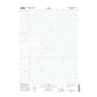
2017 Map of Wildcat Mountain NW
USGS Topo · Published 2017About this map
The Great Salt Lake Desert dominates this landscape in the western reach of Tooele County. This 2017 topographic record focuses on a largely uninhabited expanse of the salt flats, defined by its stark geological character and the grid of the Public Land Survey System. The map illustrates the convergence of several township boundaries, including T4s R14w, T4s R15w, T5s R14w, and T5s R15w. Topographic contours reveal subtle elevation changes across the basin floor, providing a precise guide for those studying the physical geography of this arid environment or tracing land divisions within the desert's vast salt crust.
Find a feature on this map
5 named features on this map. Tap any name to fly to it.
Don’t see what you’re looking for? This feature index may not catch every label — zoom into the map to look around manually.
Map Details
Editions of this 2017 Wildcat Mountain NW Map
This is the sole edition of this map. No revisions or reprints were ever made.
Other maps of this area

1953 · Tooele
USGS Topo · 1:250,000

1954 · Wildcat Mtn
USGS Topo · 1:24,000

1954 · Wildcat Mtn SE
USGS Topo · 1:24,000

1955 · Tooele
USGS Topo · 1:250,000

1973 · Knolls SW
USGS Topo · 1:24,000

1973 · Arinosa SE
USGS Topo · 1:24,000

1973 · Wildcat Mountain SW
USGS Topo · 1:24,000

1973 · Wildcat Mountain NW
USGS Topo · 1:24,000

1973 · Gold Hill 1 SE
USGS Topo · 1:24,000

1973 · Knolls SE
USGS Topo · 1:24,000