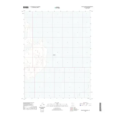
2020 Map of Wildcat Mountain NW
USGS Topo · Published 2020About this map
Great Salt Lake Desert dominates this 2020 landscape in western Utah, revealing the stark, low-elevation geography of the Basin and Range province. This survey focus resides in the Tooele County expanse, where the topography is defined by the flat alkali crusts and subtle elevation shifts characteristic of the ancient Lake Bonneville bed. The detailed contour intervals of the Bureau of Land Management and USGS data illustrate the vastness of this environment, highlighting the isolation of the interior desert where few man-made landmarks or permanent water sources exist. It serves as a precise modern baseline for understanding the hydrology and land management of these public lands, capturing the area before any potential shifts in shoreline or vegetation patterns occur in this sensitive arid ecosystem.
Find a feature on this map
1 named feature on this map. Tap any name to fly to it.
Don’t see what you’re looking for? This feature index may not catch every label — zoom into the map to look around manually.
Map Details
Editions of this 2020 Wildcat Mountain NW Map
This is the sole edition of this map. No revisions or reprints were ever made.
Other maps of this area

1953 · Tooele
USGS Topo · 1:250,000

1954 · Wildcat Mtn
USGS Topo · 1:24,000

1954 · Wildcat Mtn SE
USGS Topo · 1:24,000

1955 · Tooele
USGS Topo · 1:250,000

1973 · Knolls SW
USGS Topo · 1:24,000

1973 · Arinosa SE
USGS Topo · 1:24,000

1973 · Wildcat Mountain SW
USGS Topo · 1:24,000

1973 · Wildcat Mountain NW
USGS Topo · 1:24,000

1973 · Gold Hill 1 SE
USGS Topo · 1:24,000

1973 · Knolls SE
USGS Topo · 1:24,000