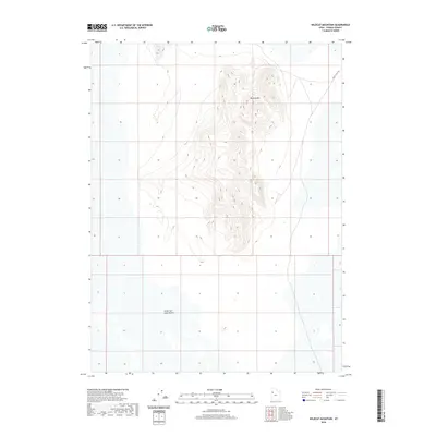
2020 Map of Wildcat Mountain
USGS Topo · Published 2020About this map
Wildcat Mtn rises from the floor of the Great Salt Lake Desert, serving as a stark topographic island within this expansive salt flat in Tooele County. This 2020 survey records the intricate contour lines of the mountain’s ridges and ravines, providing an exceptionally detailed view of the terrain that has long served as a landmark for those navigating the arid basin. To the northeast, White Rock Rd skirts the edge of the desert floor, representing one of the few established routes through this isolated landscape. The map emphasizes the vast, undeveloped character of the salt desert, where land use is dictated by the extreme environment and the natural drainage patterns that flow from the isolated slopes of the peak into the surrounding flats.
Find a feature on this map
3 named features on this map. Tap any name to fly to it.
Don’t see what you’re looking for? This feature index may not catch every label — zoom into the map to look around manually.
Map Details
Editions of this 2020 Wildcat Mountain Map
This is the sole edition of this map. No revisions or reprints were ever made.
Other maps of this area

1953 · Tooele
USGS Topo · 1:250,000

1954 · Wig Mtn SW
USGS Topo · 1:24,000

1954 · Wildcat Mtn
USGS Topo · 1:24,000

1954 · Wildcat Mtn SE
USGS Topo · 1:24,000

1954 · Wig Mtn NW
USGS Topo · 1:24,000

1955 · Tooele
USGS Topo · 1:250,000

1973 · Knolls SW
USGS Topo · 1:24,000

1973 · Wildcat Mountain SW
USGS Topo · 1:24,000

1973 · Wildcat Mountain NW
USGS Topo · 1:24,000

1973 · Knolls SE
USGS Topo · 1:24,000