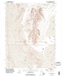
1993 Map of Wildcat Mountain
USGS Topo · Published 1996About this map
Wildcat Mountain rises sharply from the surrounding desert floor within the extensive Utah Test and Training Range in Tooele County. This arid landscape is dominated by shifting Sand Dunes and expansive Mud Flat terrain, illustrating the harsh geography of the Great Salt Lake Desert. The isolation of the mountain made it a logical site for military operations, as evidenced by several designated Landing Strip locations cleared along the base of the ridges. Sparse signs of earlier human activity appear on the northern slopes of the mountain, where a Tunnel and various prospects suggest historic attempts at mineral extraction. The map reveals the stark intersection of mid-century mining exploration and late-twentieth-century military training infrastructure, set against a backdrop of natural geological formations in a remote corner of Utah.
Find a feature on this map
10 named features on this map. Tap any name to fly to it.
Don’t see what you’re looking for? This feature index may not catch every label — zoom into the map to look around manually.
Map Details
Editions of this 1993 Wildcat Mountain Map
This is the sole edition of this map. No revisions or reprints were ever made.
Other maps of this area

1953 · Tooele
USGS Topo · 1:250,000

1954 · Wig Mtn SW
USGS Topo · 1:24,000

1954 · Wildcat Mtn
USGS Topo · 1:24,000

1954 · Wildcat Mtn SE
USGS Topo · 1:24,000

1954 · Wig Mtn NW
USGS Topo · 1:24,000

1955 · Tooele
USGS Topo · 1:250,000

1973 · Knolls SW
USGS Topo · 1:24,000

1973 · Wildcat Mountain SW
USGS Topo · 1:24,000

1973 · Wildcat Mountain NW
USGS Topo · 1:24,000

1973 · Knolls SE
USGS Topo · 1:24,000