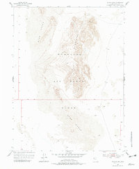
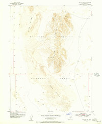
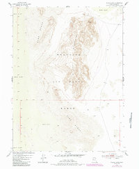
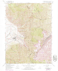
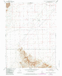
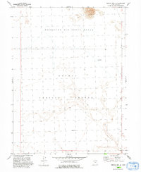
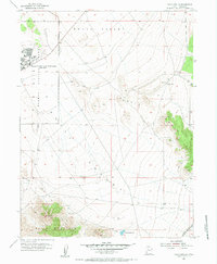
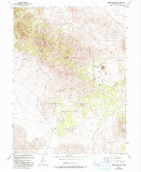
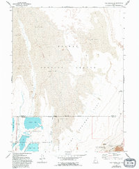
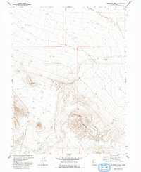
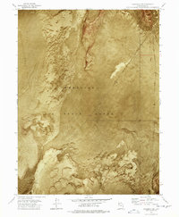
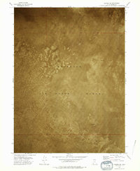
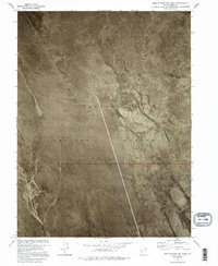
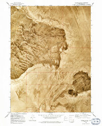
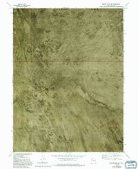
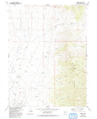
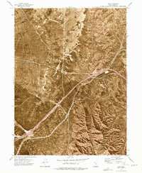
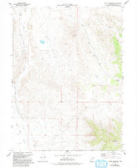
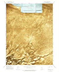
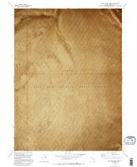
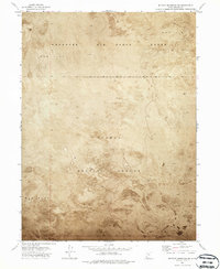
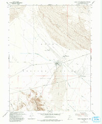
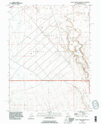
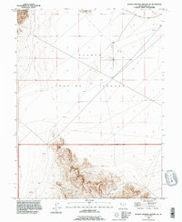
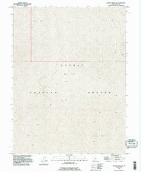
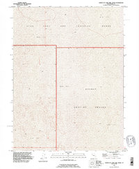
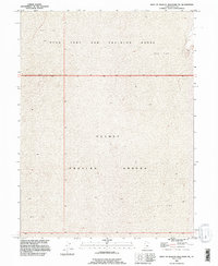
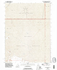
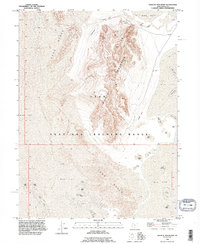
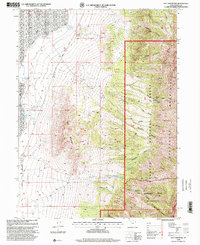
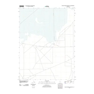
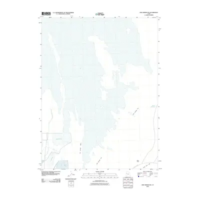
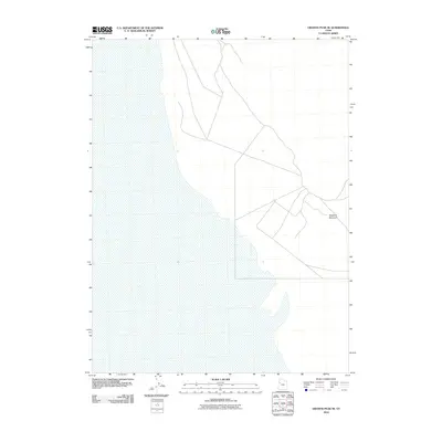
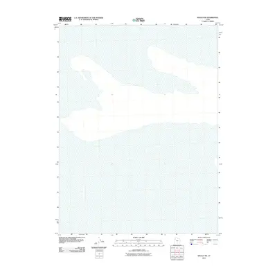
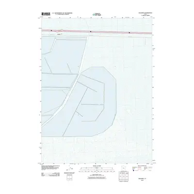
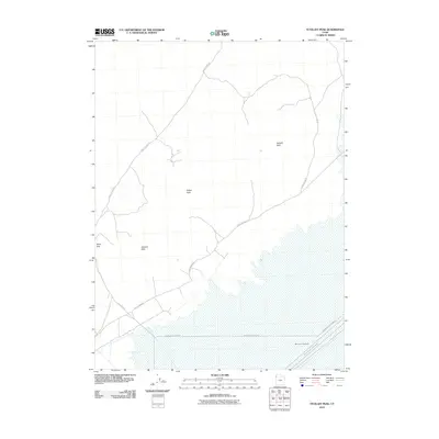
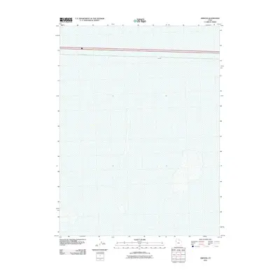
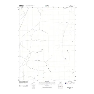
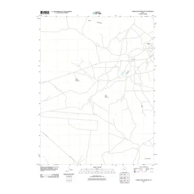
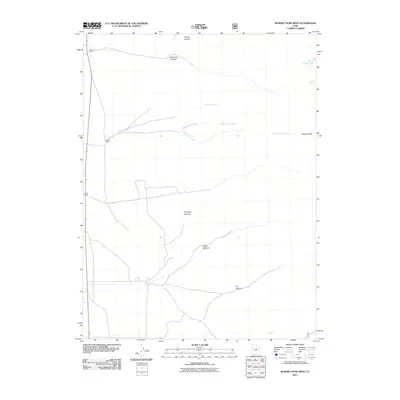
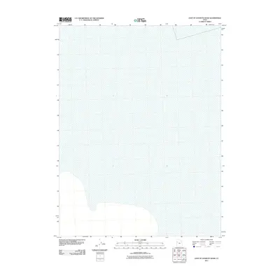
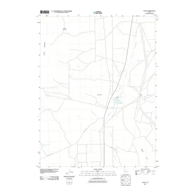
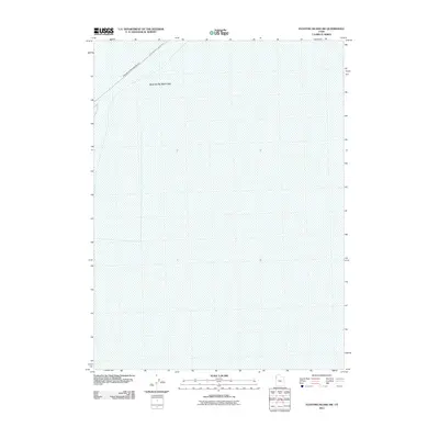
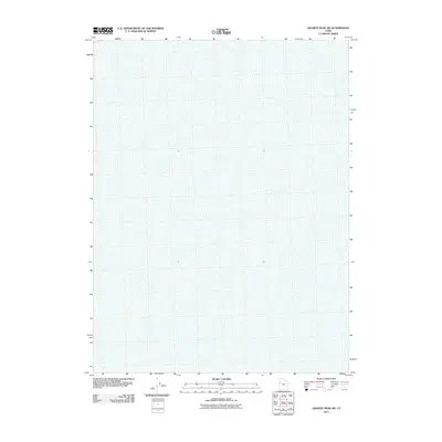
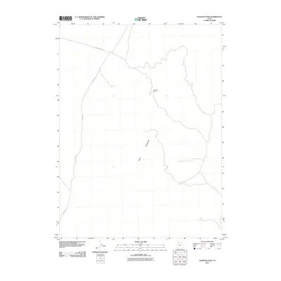
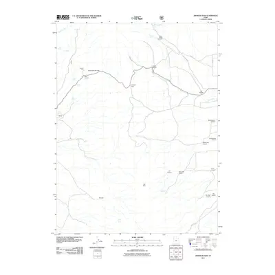
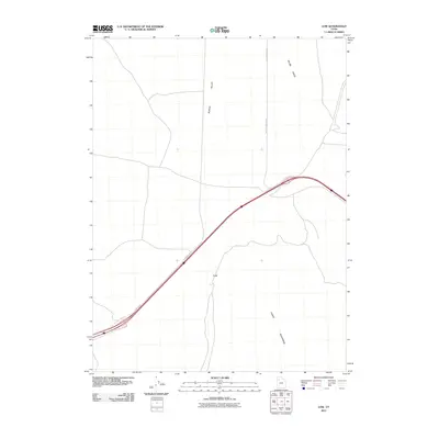
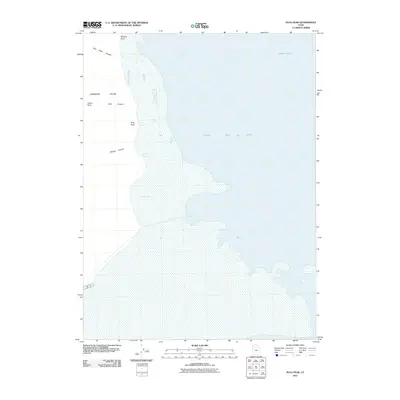
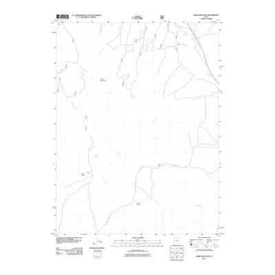
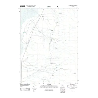
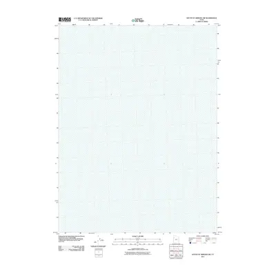
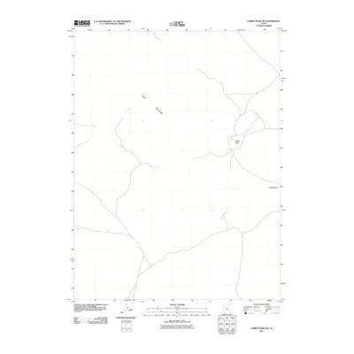
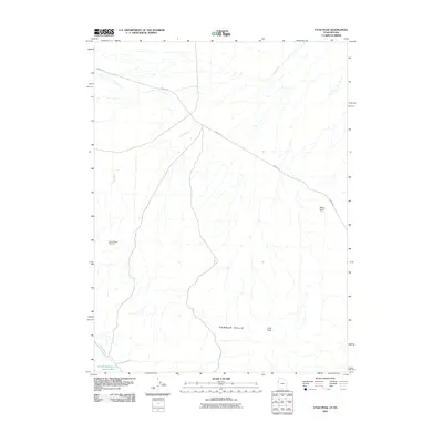
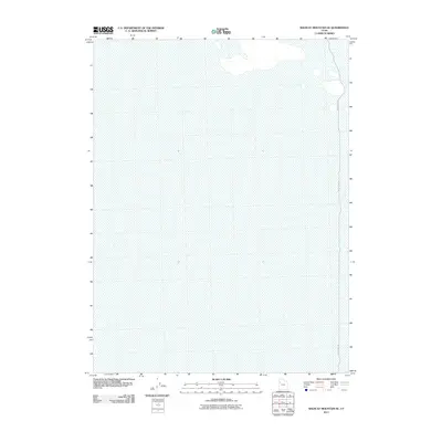
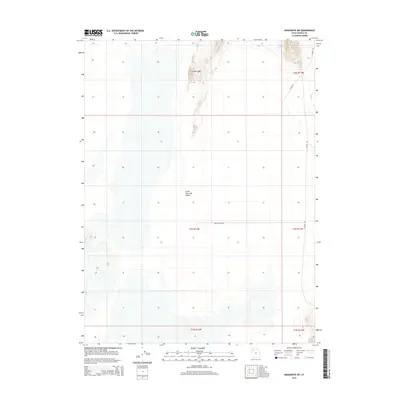
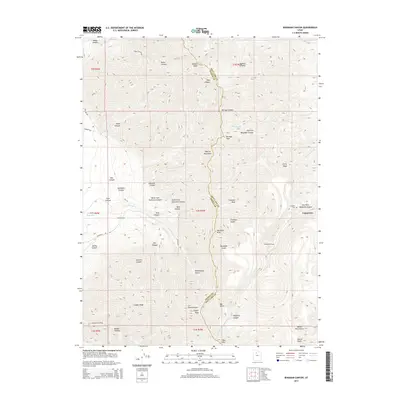
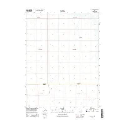
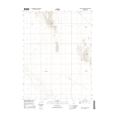
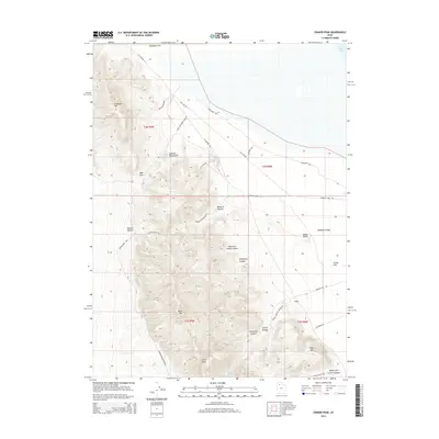
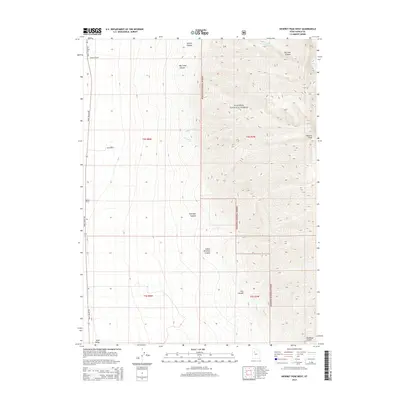
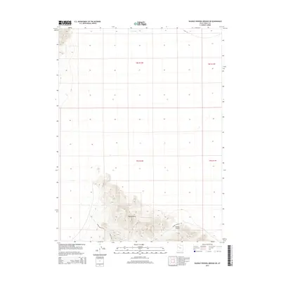
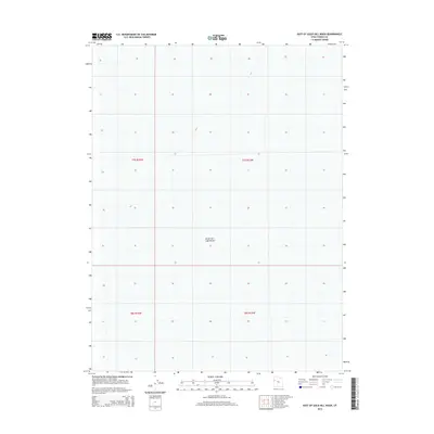
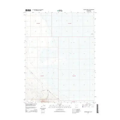
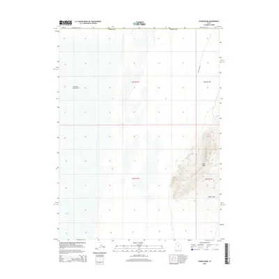
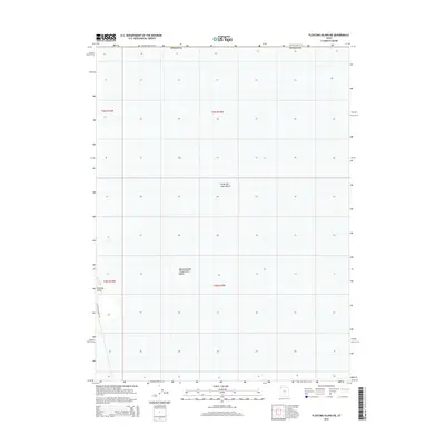
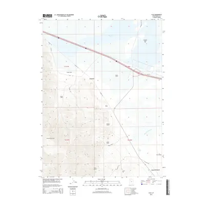
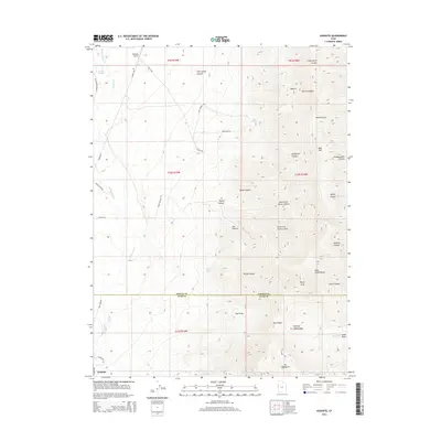
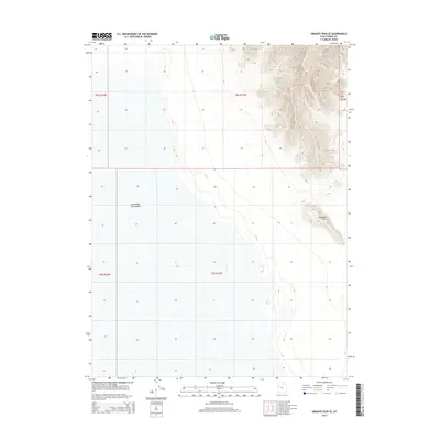
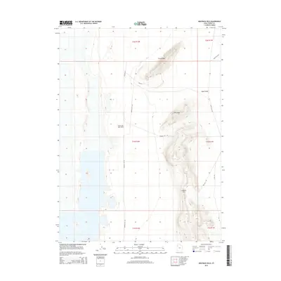
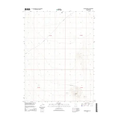
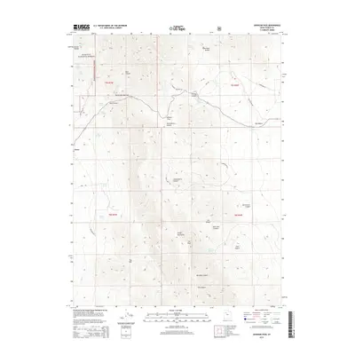
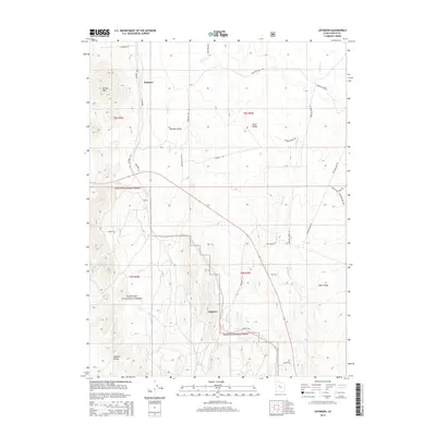
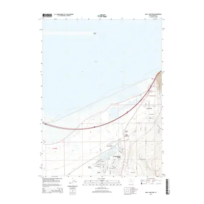
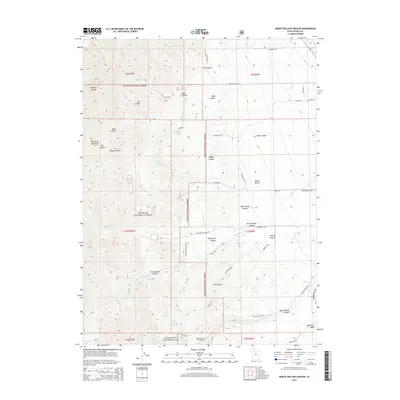
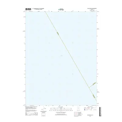
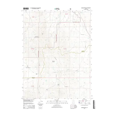
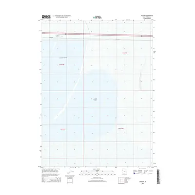
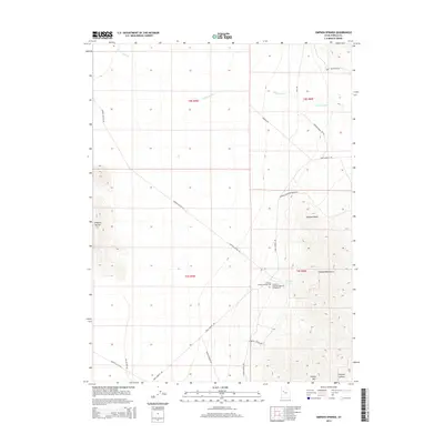
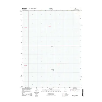
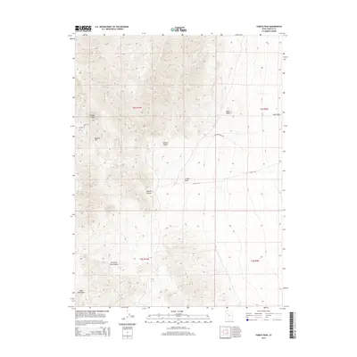
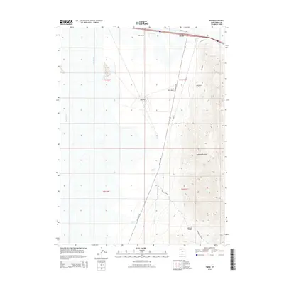
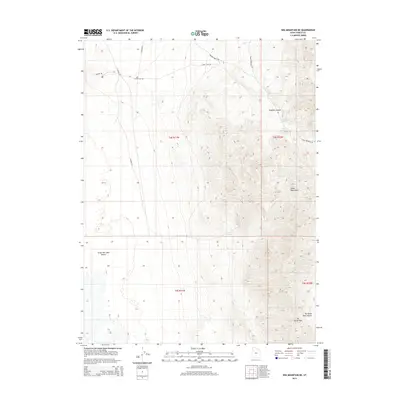
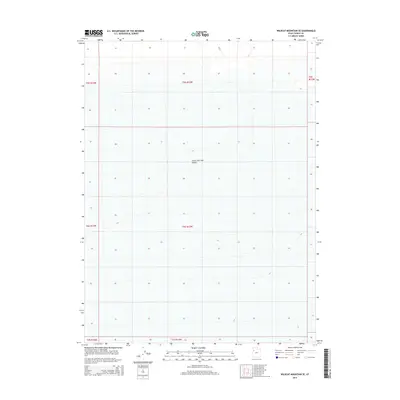
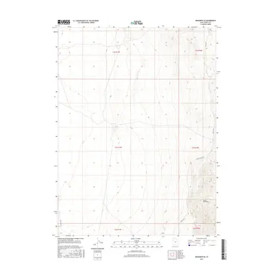
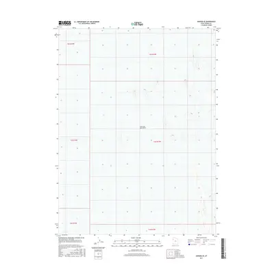
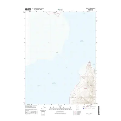
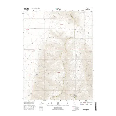
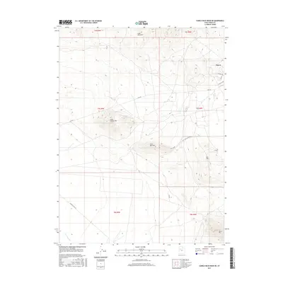
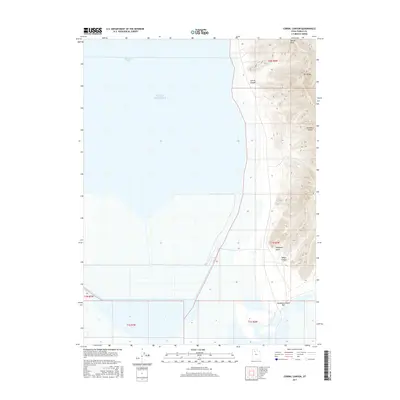
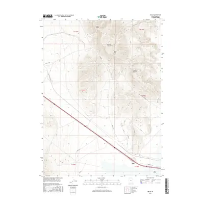
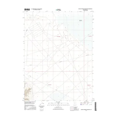
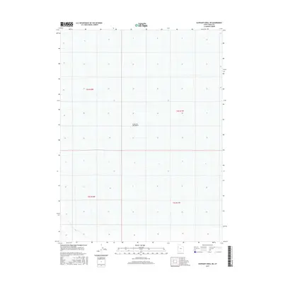
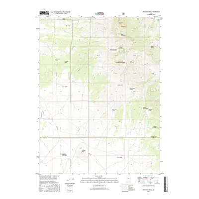
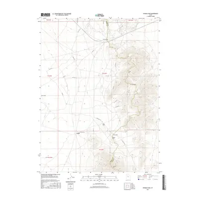
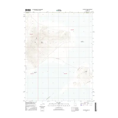
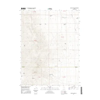
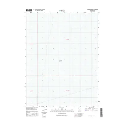
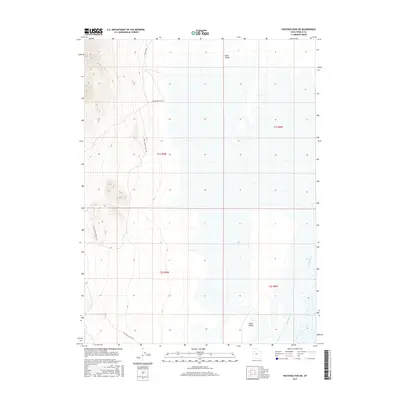
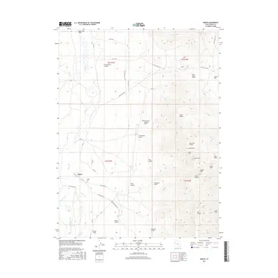
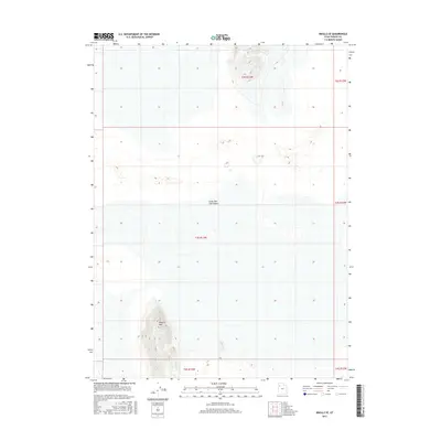
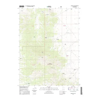
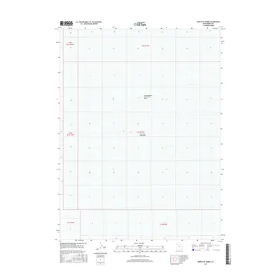
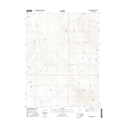
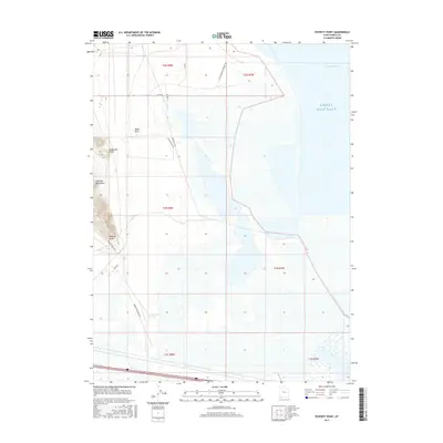
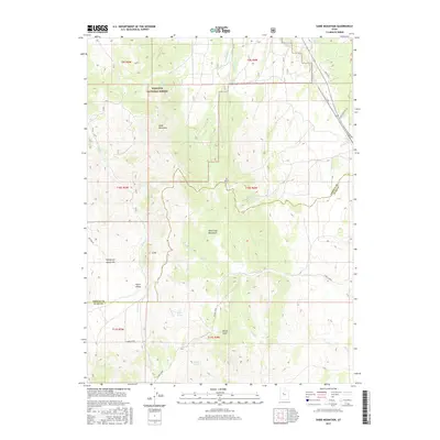
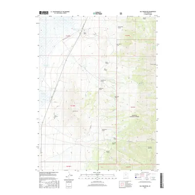
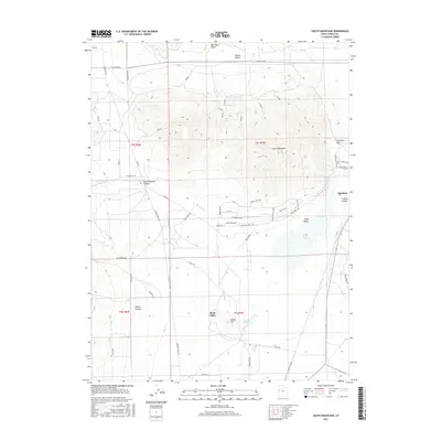
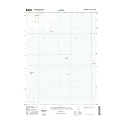
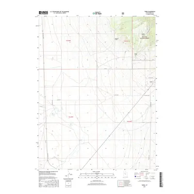
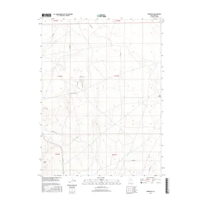
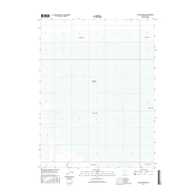
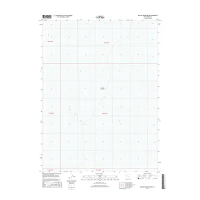
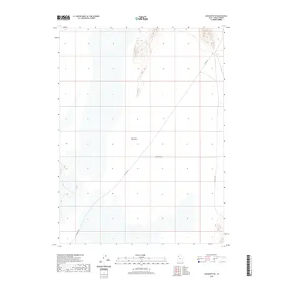
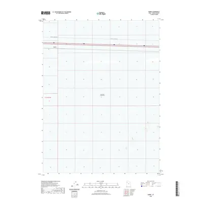
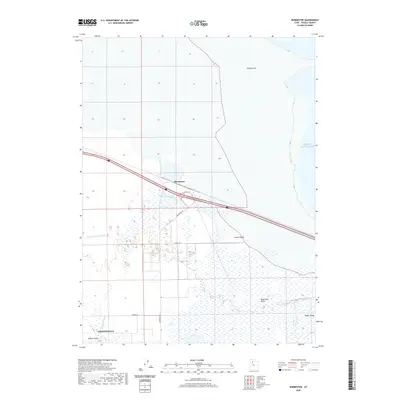
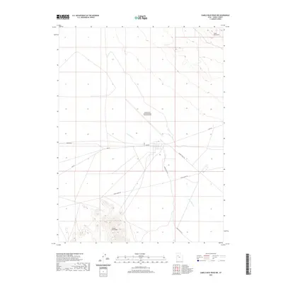
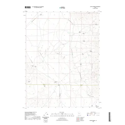
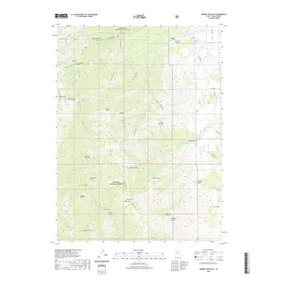
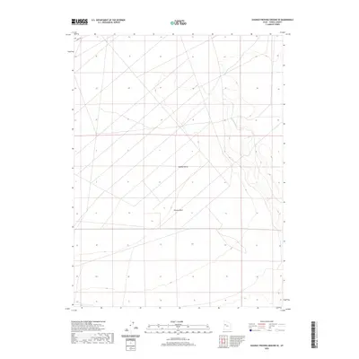
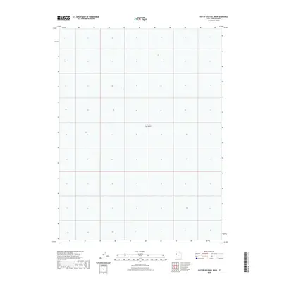
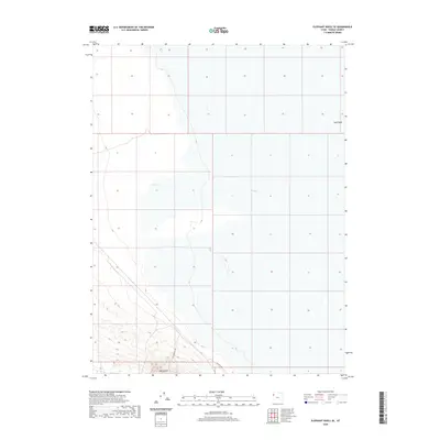
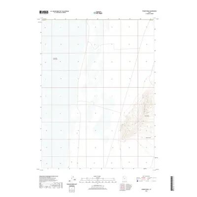
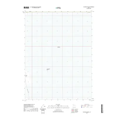
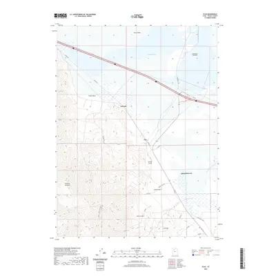
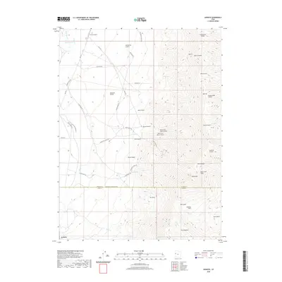
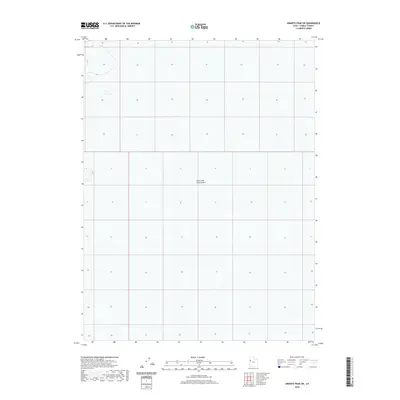
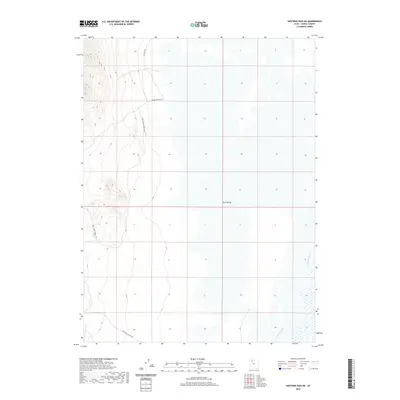
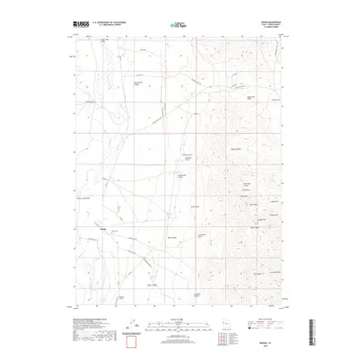
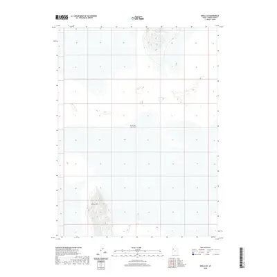
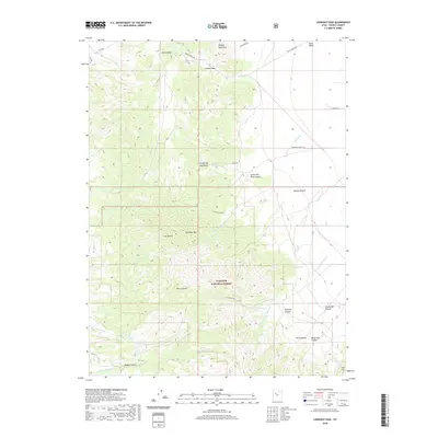
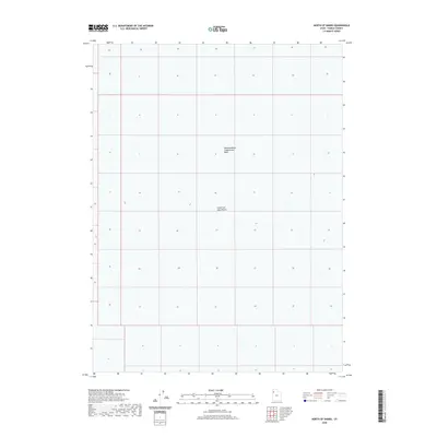
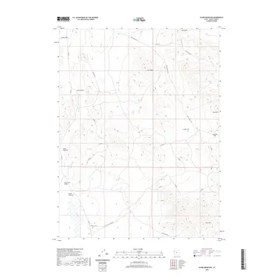
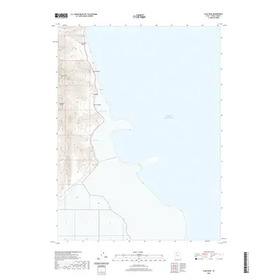
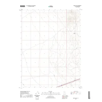
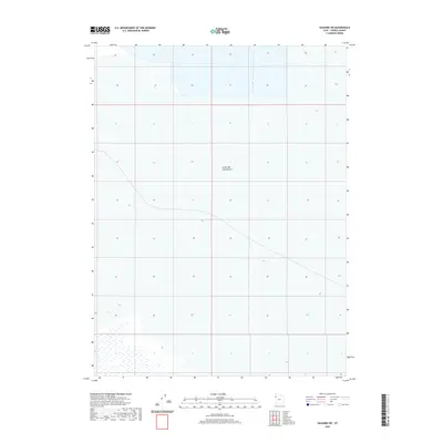
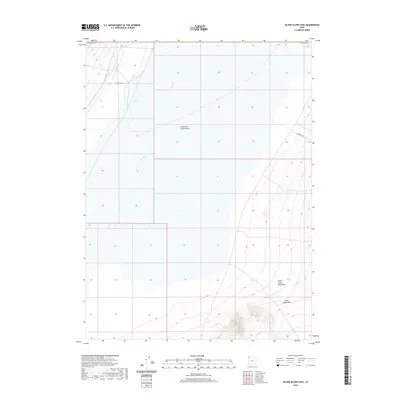
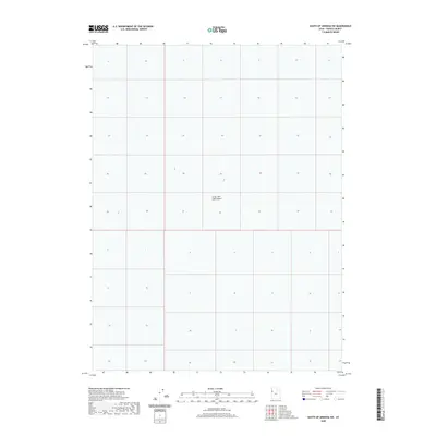
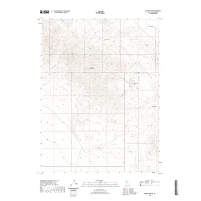
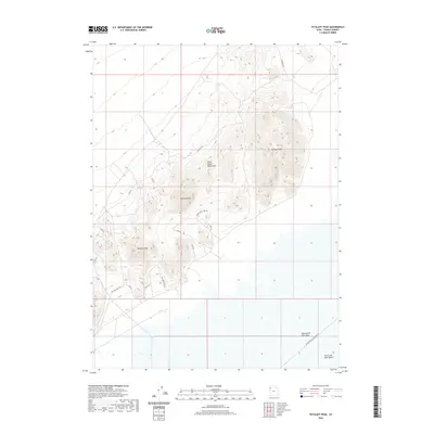
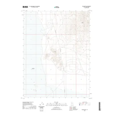
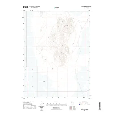
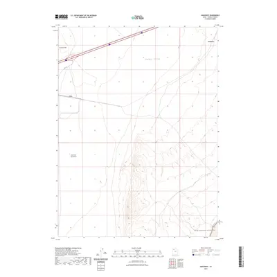
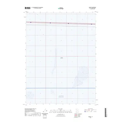
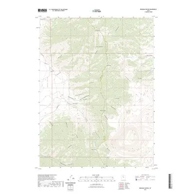
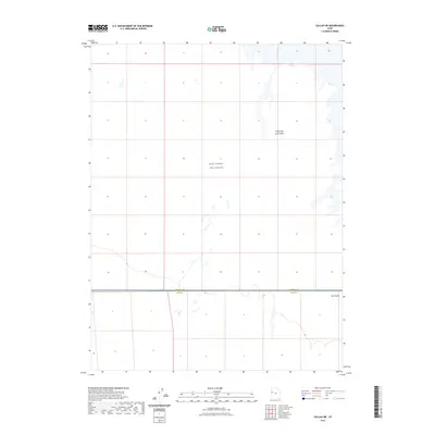
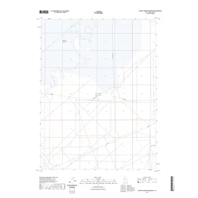
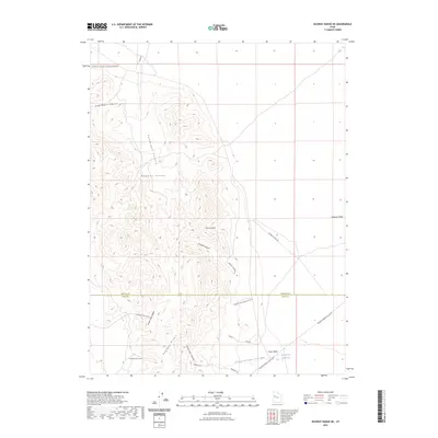
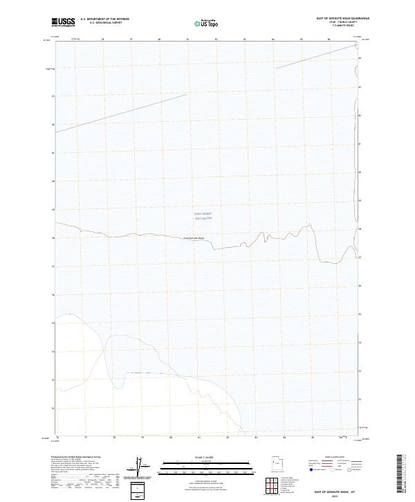
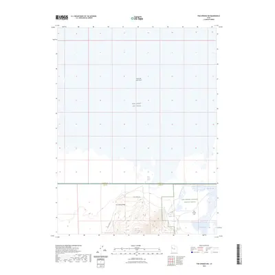
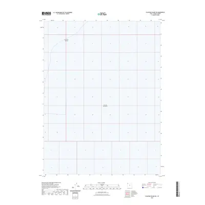
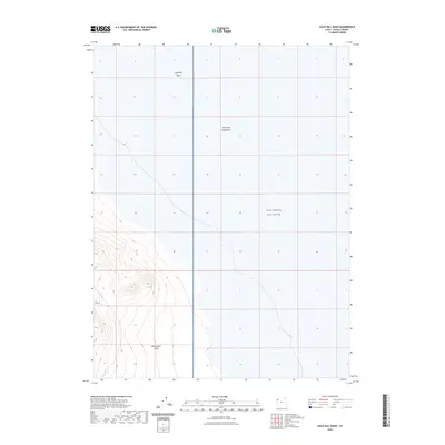
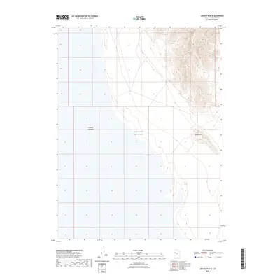
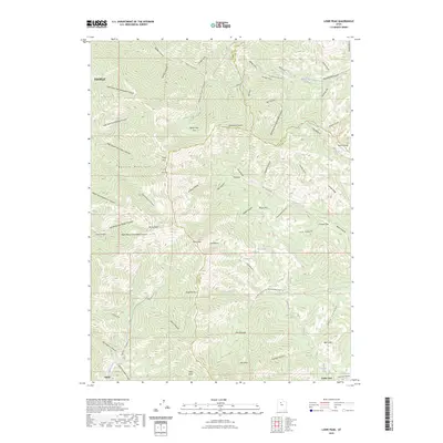
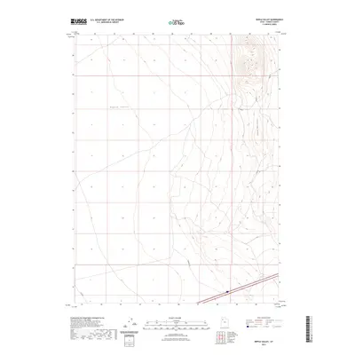
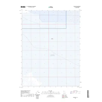
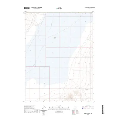
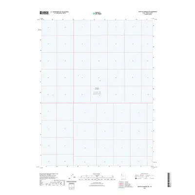
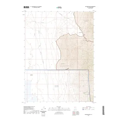
1954 Map of Wildcat Mtn
USGS Topo · Published 1979About this map
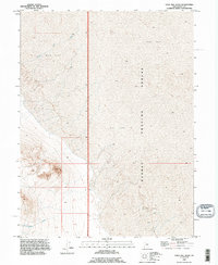
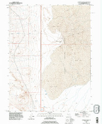
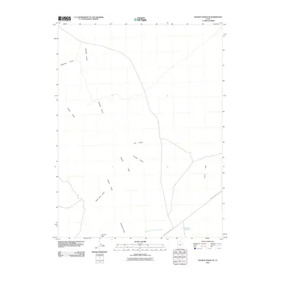
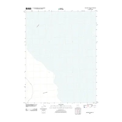
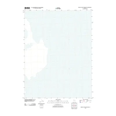
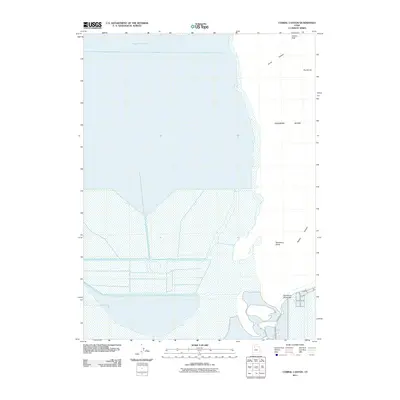
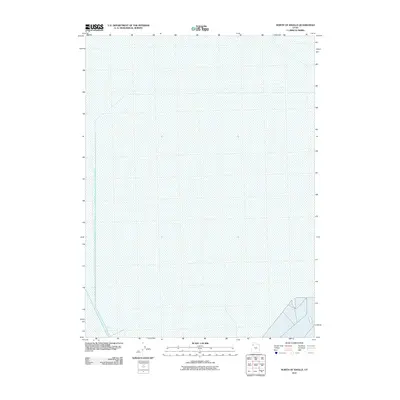
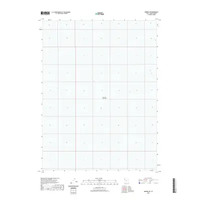
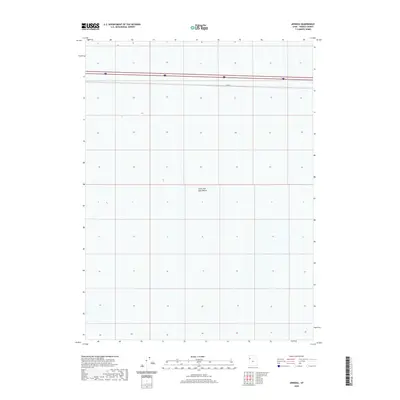
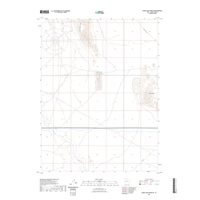
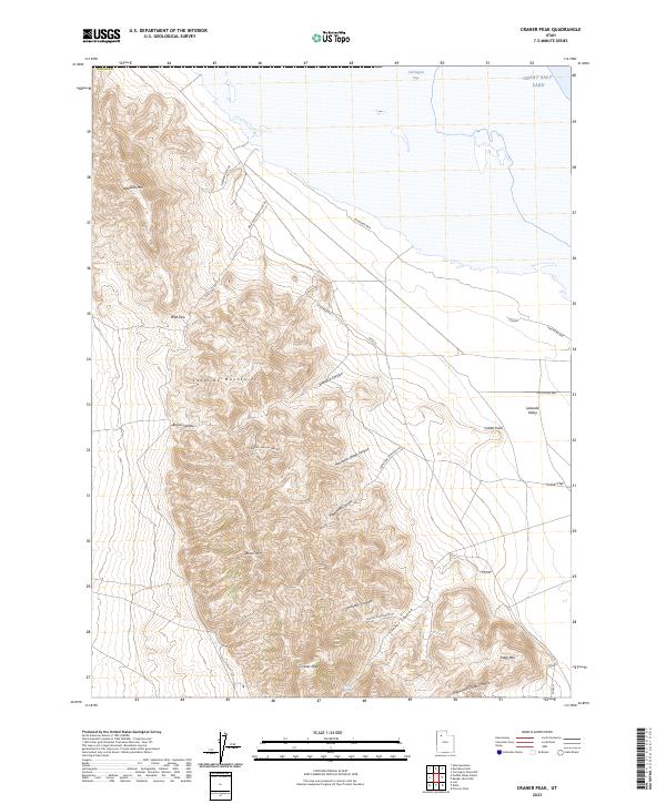
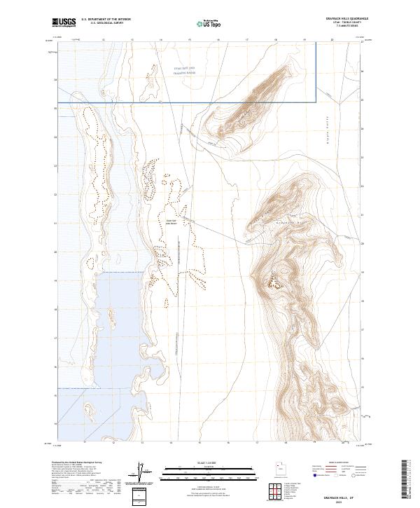
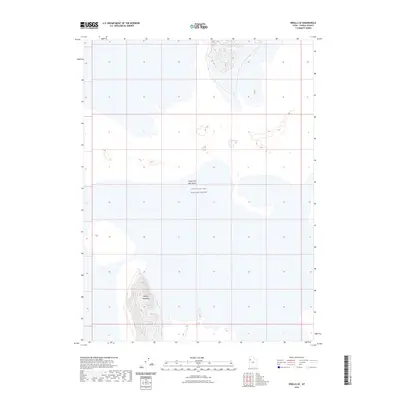
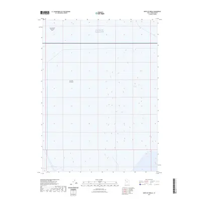
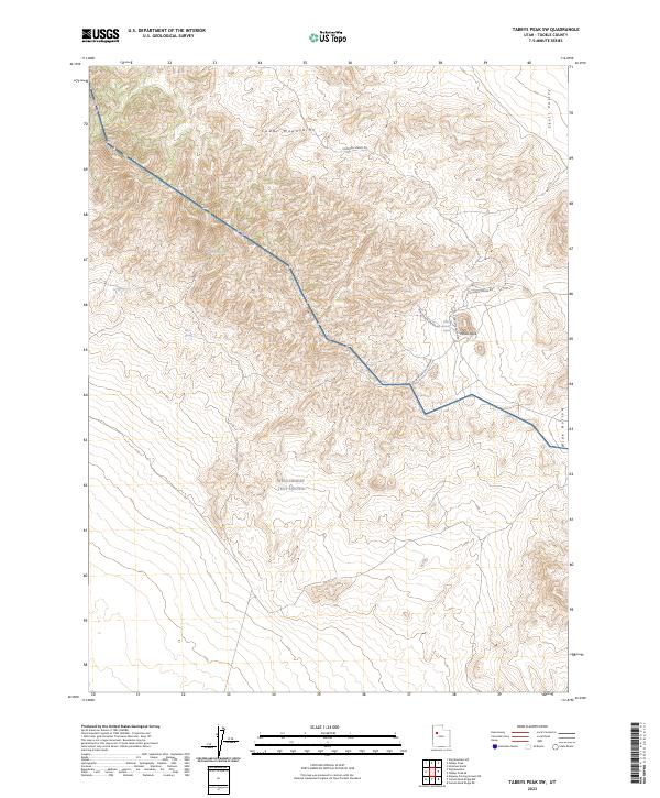
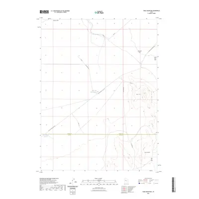
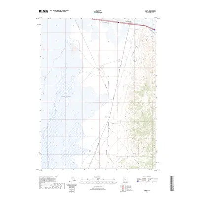
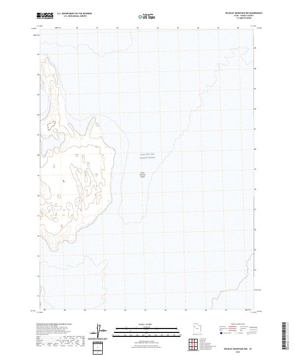
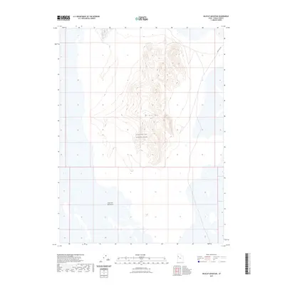
Wildcat Mountain rises sharply as a central landform on this mid-century survey, surrounded by the shifting terrain of the northern and southern Sand Dunes. This isolated topographic feature served a strategic purpose during the era, designated as part of the Wendover Air Force Range. The map reveals the intersection of military utility and natural desert geology, with several Prospects noted on the northern slopes of the mountain, indicating early mineral exploration in this arid stretch of Tooele County. The sparse infrastructure recorded in the 1950s highlights the remote nature of this training ground, where the only markings are topographic contours and section lines such as T 4 S T 5 S and R 14 W R 13 W, defining the rugged landscape of the Great Salt Lake Desert.
Find a feature on this map
7 named features on this map. Tap any name to fly to it.
Don’t see what you’re looking for? This feature index may not catch every label — zoom into the map to look around manually.
Map Details
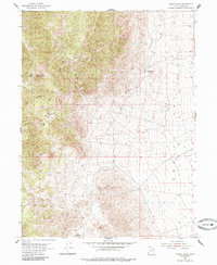
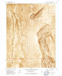
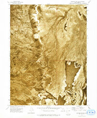
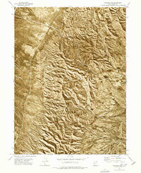
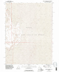
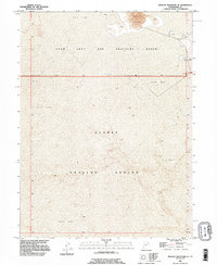
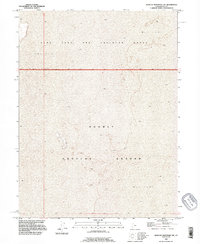
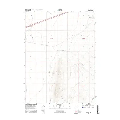
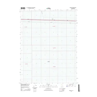
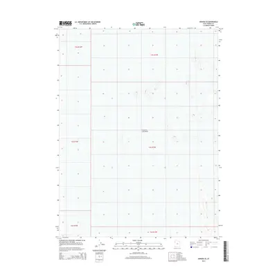
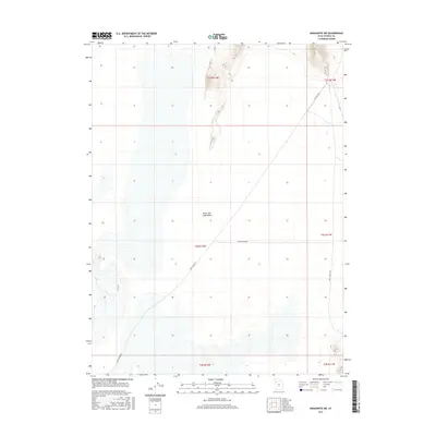
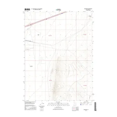
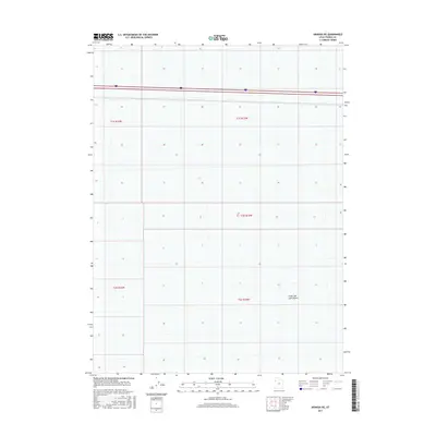
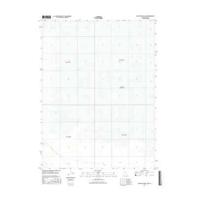
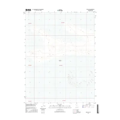
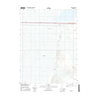
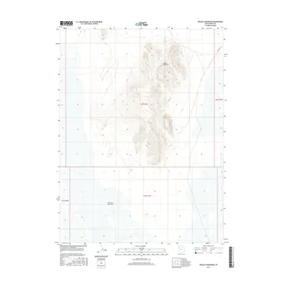
Editions of this 1954 Wildcat Mtn Map
4 editions found
Historical Maps of Tooele County Through Time
819 maps found

1885 Tooele Valley
Tooele County, UT
1925 Gold Hill
Tooele County, UT

1928 Gold Hill
Tooele County, UT

1947 Boulter Peak
Tooele County, UT

1949 Fivemile Pass
Tooele County, UT
1952 Bingham Canyon
Tooele County, UT

1953 Dugway Range NE
Tooele County, UT

1953 Dugway Range NW
Tooele County, UT
1954 Camels Back Ridge NW
Tooele County, UT
1954 Dugway Proving Ground NE
Tooele County, UT
1954 Dugway Proving Ground NW
Tooele County, UT

1954 Dugway Proving Ground SE
Tooele County, UT
1954 Dugway Proving Ground SW
Tooele County, UT
1954 Granite Peak SE
Tooele County, UT
1954 Granite Peak
Tooele County, UT
1954 Wig Mtn NW
Tooele County, UT

1954 Wig Mtn SW
Tooele County, UT
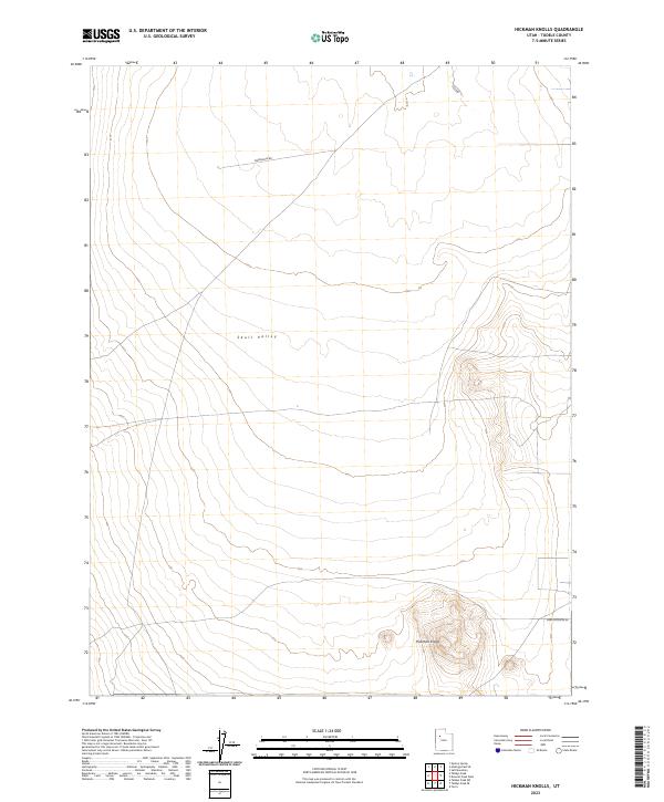
1954 Wildcat Mountain SE
Tooele County, UT
1954 Wildcat Mountain
Tooele County, UT

1955 Burmester
Tooele County, UT
1955 Camels Back Ridge NE
Tooele County, UT
1955 Camels Back Ridge SW
Tooele County, UT

1955 Coyote Springs
Tooele County, UT
1955 Davis Knolls
Tooele County, UT

1955 Deseret Peak
Tooele County, UT

1955 Indian Peaks
Tooele County, UT
1955 Indian Springs
Tooele County, UT

1955 Mills Junction
Tooele County, UT
1955 Simpson Springs
Tooele County, UT
1955 Tabbys Peak SE
Tooele County, UT
1955 Tabbys Peak SW
Tooele County, UT
1955 Tabbys Peak
Tooele County, UT

1955 Table Mountain
Tooele County, UT

1955 Timpie
Tooele County, UT

1955 Wig Mtn NE
Tooele County, UT

1955 Wig Mtn
Tooele County, UT
1963 Dutch Peak
Tooele County, UT
1963 Sabie Mountain
Tooele County, UT
1967 Fish Springs NE
Tooele County, UT
1967 Fish Springs NW
Tooele County, UT

1968 Badger Island NW
Tooele County, UT

1968 Badger Island
Tooele County, UT

1968 Corral Canyon
Tooele County, UT

1968 Craner Peak
Tooele County, UT

1968 Lowe Peak
Tooele County, UT

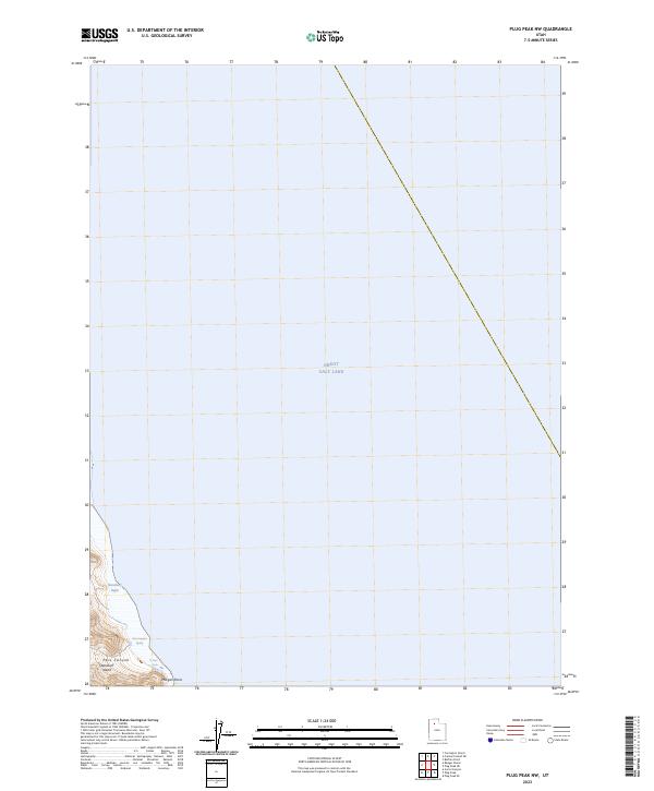
1968 Plug Peak NW
Tooele County, UT

1968 Plug Peak SE
Tooele County, UT
1968 Plug Peak
Tooele County, UT

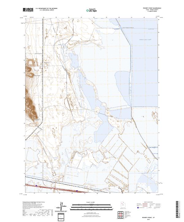
1968 Poverty Point
Tooele County, UT

1971 Bonneville Racetrack
Tooele County, UT

1971 Erickson Knoll
Tooele County, UT

1971 Faust
Tooele County, UT

1971 Graham Peak
Tooele County, UT

1971 Lofgreen
Tooele County, UT

1971 Lookout Pass
Tooele County, UT

1971 Onaqui Mts South
Tooele County, UT

1971 Silver Island Pass
Tooele County, UT

1971 Tetzlaff Peak
Tooele County, UT

1971 Vernon NE
Tooele County, UT

1972 Burmester
Tooele County, UT
1972 Elephant Knoll NE
Tooele County, UT

1972 Elephant Knoll NW
Tooele County, UT

1972 Elephant Knoll SE
Tooele County, UT
1972 Elephant Knoll
Tooele County, UT

1972 Goshute Canyon
Tooele County, UT
1972 Goshute
Tooele County, UT
1972 Mills Junction
Tooele County, UT
1973 Aragonite NW
Tooele County, UT

1973 Aragonite SE
Tooele County, UT
1973 Aragonite SW
Tooele County, UT
1973 Aragonite
Tooele County, UT
1973 Arinosa NE
Tooele County, UT
1973 Arinosa SE
Tooele County, UT
1973 Arinosa SW
Tooele County, UT
1973 Arinosa
Tooele County, UT
1973 Barro
Tooele County, UT

1973 Clifton
Tooele County, UT
1973 Delle
Tooele County, UT
1973 East of Gold Hill Wash
Tooele County, UT
1973 East of Goshute Wash
Tooele County, UT
1973 Finger Ridge
Tooele County, UT
1973 Floating Island NE
Tooele County, UT
1973 Floating Island SE
Tooele County, UT
1973 Floating Island SW
Tooele County, UT
1973 Floating Island
Tooele County, UT
1973 Gold Hill
Tooele County, UT

1973 Gold Hill Wash
Tooele County, UT

1973 Goshute Wash
Tooele County, UT

1973 Granite Peak NW
Tooele County, UT
1973 Granite Peak SW
Tooele County, UT

1973 Grassy Mountains
Tooele County, UT
1973 Grayback Hills
Tooele County, UT
1973 Hastings Pass NE
Tooele County, UT

1973 Hastings Pass SE
Tooele County, UT
1973 Hastings Pass
Tooele County, UT

1973 Hickman Knolls
Tooele County, UT
1973 Ibapah
Tooele County, UT
1973 Knolls SE
Tooele County, UT
1973 Knolls SW
Tooele County, UT
1973 Knolls
Tooele County, UT
1973 Low
Tooele County, UT
1973 North of Barro
Tooele County, UT
1973 North of Gold Hill Wash
Tooele County, UT
1973 North of Knolls
Tooele County, UT
1973 Ochre Mountain
Tooele County, UT
1973 Puddle Valley Knolls
Tooele County, UT

1973 Quincy Spring
Tooele County, UT
1973 Ripple Valley
Tooele County, UT
1973 Salduro SE
Tooele County, UT
1973 Salduro SW
Tooele County, UT
1973 Salduro
Tooele County, UT

1973 Silsbee
Tooele County, UT
1973 South of Arinosa SE
Tooele County, UT
1973 South of Arinosa SW
Tooele County, UT
1973 South of Big Pass
Tooele County, UT
1973 South of Keller Well
Tooele County, UT
1973 West of Wildcat Mountain SW
Tooele County, UT
1973 Wildcat Mountain NW
Tooele County, UT
1973 Wildcat Mountain SW
Tooele County, UT

1979 Bonneville Salt Flats
Tooele County, UT

1979 Wildcat Mountain
Tooele County, UT

1980 Saint John
Tooele County, UT
1980 South Mountain
Tooele County, UT

1985 Deseret Peak East
Tooele County, UT

1985 Deseret Peak West
Tooele County, UT

1985 Flux
Tooele County, UT

1985 Johnson Pass
Tooele County, UT
1985 North Willow Canyon
Tooele County, UT

1985 Salt Mountain
Tooele County, UT

1985 Terra
Tooele County, UT

1985 Timpie
Tooele County, UT

1991 Wildcat Mountain SE
Tooele County, UT

1993 Boulter Peak
Tooele County, UT

1993 Callao NE
Tooele County, UT

1993 Callao
Tooele County, UT
1993 Camels Back Ridge NE
Tooele County, UT
1993 Camels Back Ridge NW
Tooele County, UT

1993 Camels Back Ridge SW
Tooele County, UT
1993 Davis Knolls
Tooele County, UT
1993 Dugway Proving Ground NE
Tooele County, UT
1993 Dugway Proving Ground NW
Tooele County, UT
1993 Dugway Proving Ground SE
Tooele County, UT
1993 Dugway Proving Ground SW
Tooele County, UT

1993 Dugway Range NE
Tooele County, UT

1993 Dugway Range NW
Tooele County, UT
1993 East of Gold Hill Wash
Tooele County, UT
1993 East of Goshute Wash
Tooele County, UT

1993 Faust
Tooele County, UT

1993 Fish Springs NE
Tooele County, UT

1993 Fish Springs NW
Tooele County, UT

1993 Fivemile Pass
Tooele County, UT
1993 Gold Hill Wash
Tooele County, UT
1993 Goshute Wash
Tooele County, UT
1993 Granite Peak NW
Tooele County, UT
1993 Granite Peak SE
Tooele County, UT
1993 Granite Peak SW
Tooele County, UT
1993 Granite Peak
Tooele County, UT
1993 Hickman Knolls
Tooele County, UT

1993 Indian Peaks
Tooele County, UT

1993 Lofgreen
Tooele County, UT
1993 Lookout Pass
Tooele County, UT

1993 Lowe Peak
Tooele County, UT
1993 North of Gold Hill Wash
Tooele County, UT

1993 Onaqui Mts South
Tooele County, UT

1993 Saint John
Tooele County, UT
1993 Simpson Springs
Tooele County, UT

1993 South Mountain
Tooele County, UT
1993 South of Arinosa SE
Tooele County, UT

1993 Tabbys Peak SE
Tooele County, UT

1993 Tabbys Peak
Tooele County, UT
1993 Vernon NE
Tooele County, UT
1993 West of Wildcat Mountain SW
Tooele County, UT
1993 Wig Mountain
Tooele County, UT
1993 Wig Mtn NE
Tooele County, UT
1993 Wig Mtn NW
Tooele County, UT
1993 Wig Mtn SW
Tooele County, UT
1993 Wildcat Mountain NW
Tooele County, UT
1993 Wildcat Mountain SE
Tooele County, UT
1993 Wildcat Mountain SW
Tooele County, UT
1993 Wildcat Mountain
Tooele County, UT

1997 Bingham Canyon
Tooele County, UT

1997 Lowe Peak
Tooele County, UT
1998 Deseret Peak East
Tooele County, UT

1998 Deseret Peak West
Tooele County, UT

1998 Dutch Peak
Tooele County, UT

1998 Erickson Knoll
Tooele County, UT

1998 Indian Peaks
Tooele County, UT

1998 Indian Springs
Tooele County, UT
1998 Johnson Pass
Tooele County, UT

1998 Lofgreen
Tooele County, UT
1998 Lookout Pass
Tooele County, UT

1998 North Willow Canyon
Tooele County, UT

1998 Sabie Mountain
Tooele County, UT
1998 Salt Mountain
Tooele County, UT

1998 Terra
Tooele County, UT
2010 Aragonite NW
Tooele County, UT
2010 Aragonite SE
Tooele County, UT
2010 Aragonite SW
Tooele County, UT
2010 Aragonite
Tooele County, UT
2010 Arinosa SE
Tooele County, UT
2010 Barro
Tooele County, UT
2010 Coyote Springs
Tooele County, UT
2010 Dugway Proving Ground NE
Tooele County, UT
2010 Dugway Proving Ground NW
Tooele County, UT
2010 Dugway Proving Ground SE
Tooele County, UT
2010 Dugway Proving Ground SW
Tooele County, UT
2010 Dugway Range NE
Tooele County, UT
2010 Elephant Knoll NW
Tooele County, UT
2010 Elephant Knoll SE
Tooele County, UT
2010 Finger Ridge
Tooele County, UT
2010 Fish Springs NE
Tooele County, UT
2010 Floating Island NE
Tooele County, UT
2010 Floating Island
Tooele County, UT
2010 Gold Hill
Tooele County, UT
2010 Gold Hill Wash
Tooele County, UT
2010 Goshute Wash
Tooele County, UT
2010 Graham Peak
Tooele County, UT
2010 Granite Peak NW
Tooele County, UT
2010 Granite Peak SE
Tooele County, UT
2010 Grassy Mountains
Tooele County, UT
2010 Grayback Hills
Tooele County, UT
2010 Ibapah
Tooele County, UT
2010 Knolls SW
Tooele County, UT
2010 Knolls
Tooele County, UT
2010 Ochre Mountain
Tooele County, UT
2010 Ripple Valley
Tooele County, UT
2010 Salduro
Tooele County, UT
2010 Silver Island Pass
Tooele County, UT
2010 South of Arinosa SE
Tooele County, UT
2010 Table Mountain
Tooele County, UT
2010 Tetzlaff Peak
Tooele County, UT
2010 Wig Mountain NE
Tooele County, UT
2010 Wig Mountain SW
Tooele County, UT
2010 Wig Mountain
Tooele County, UT
2010 Wildcat Mountain NW
Tooele County, UT
2010 Wildcat Mountain
Tooele County, UT
2011 Arinosa NE
Tooele County, UT
2011 Arinosa SW
Tooele County, UT
2011 Arinosa
Tooele County, UT
2011 Badger Island NW
Tooele County, UT

2011 Badger Island
Tooele County, UT
2011 Bingham Canyon
Tooele County, UT
2011 Bonneville Racetrack
Tooele County, UT
2011 Boulter Peak
Tooele County, UT
2011 Burmester
Tooele County, UT
2011 Callao NE
Tooele County, UT
2011 Callao
Tooele County, UT
2011 Camels Back Ridge NE
Tooele County, UT
2011 Camels Back Ridge NW
Tooele County, UT
2011 Camels Back Ridge SW
Tooele County, UT
2011 Clifton
Tooele County, UT
2011 Corral Canyon
Tooele County, UT
2011 Craner Peak
Tooele County, UT

2011 Davis Knolls
Tooele County, UT
2011 Delle
Tooele County, UT
2011 Deseret Peak East
Tooele County, UT
2011 Deseret Peak West
Tooele County, UT
2011 Dugway Range NW
Tooele County, UT
2011 Dutch Peak
Tooele County, UT
2011 East of Gold Hill Wash
Tooele County, UT
2011 East of Goshute Wash
Tooele County, UT
2011 Elephant Knoll NE
Tooele County, UT
2011 Elephant Knoll
Tooele County, UT
2011 Erickson Knoll
Tooele County, UT
2011 Faust
Tooele County, UT
2011 Fish Springs NW
Tooele County, UT
2011 Fivemile Pass
Tooele County, UT
2011 Floating Island SE
Tooele County, UT
2011 Floating Island SW
Tooele County, UT
2011 Flux
Tooele County, UT
2011 Goshute Canyon
Tooele County, UT
2011 Goshute
Tooele County, UT
2011 Granite Peak SW
Tooele County, UT
2011 Granite Peak
Tooele County, UT
2011 Hastings Pass NE
Tooele County, UT
2011 Hastings Pass SE
Tooele County, UT
2011 Hastings Pass
Tooele County, UT
2011 Hickman Knolls
Tooele County, UT
2011 Indian Peaks
Tooele County, UT
2011 Indian Springs
Tooele County, UT
2011 Johnson Pass
Tooele County, UT
2011 Knolls SE
Tooele County, UT
2011 Lofgreen
Tooele County, UT
2011 Lookout Pass
Tooele County, UT

2011 Lowe Peak
Tooele County, UT
2011 Low
Tooele County, UT
2011 Mills Junction
Tooele County, UT
2011 North of Barro
Tooele County, UT
2011 North of Gold Hill Wash
Tooele County, UT
2011 North of Knolls
Tooele County, UT
2011 North Willow Canyon
Tooele County, UT
2011 Onaqui Mountains South
Tooele County, UT
2011 Plug Peak NW
Tooele County, UT
2011 Plug Peak
Tooele County, UT
2011 Poverty Point
Tooele County, UT
2011 Puddle Valley Knolls
Tooele County, UT
2011 Quincy Spring
Tooele County, UT
2011 Sabie Mountain
Tooele County, UT
2011 Saint John
Tooele County, UT
2011 Salduro SE
Tooele County, UT
2011 Salduro SW
Tooele County, UT
2011 Salt Mountain
Tooele County, UT
2011 Silsbee
Tooele County, UT
2011 Simpson Springs
Tooele County, UT
2011 South Mountain
Tooele County, UT
2011 South of Arinosa SW
Tooele County, UT
2011 South of Big Pass
Tooele County, UT
2011 South of Keller Well
Tooele County, UT
2011 Tabbys Peak SE
Tooele County, UT
2011 Tabbys Peak SW
Tooele County, UT
2011 Tabbys Peak
Tooele County, UT
2011 Terra
Tooele County, UT
2011 Timpie
Tooele County, UT
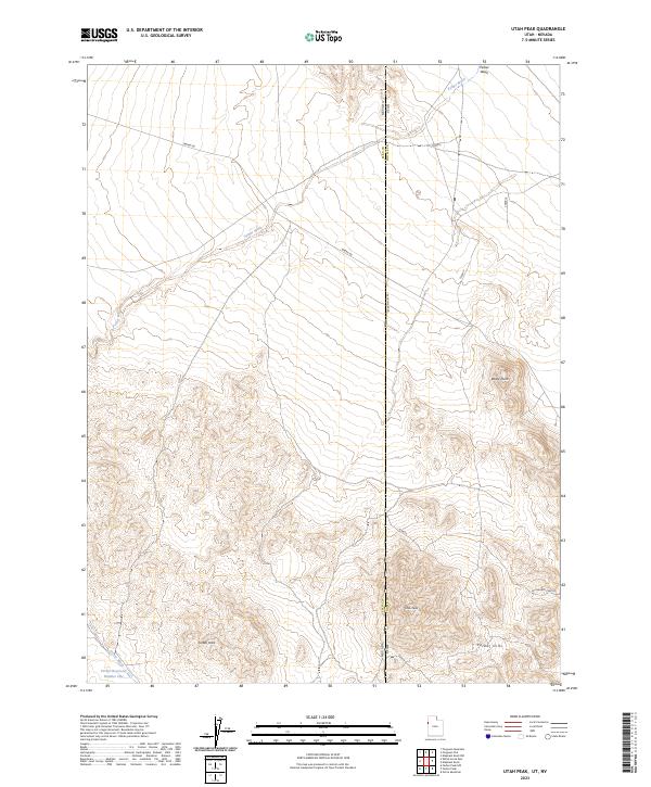
2011 Utah Peak
Tooele County, UT
2011 Vernon NE
Tooele County, UT
2011 West of Wildcat Mountain SW
Tooele County, UT
2011 Wig Mountain NW
Tooele County, UT
2011 Wildcat Mountain SE
Tooele County, UT
2011 Wildcat Mountain SW
Tooele County, UT
2014 Aragonite NW
Tooele County, UT
2014 Aragonite SE
Tooele County, UT
2014 Aragonite SW
Tooele County, UT
2014 Aragonite
Tooele County, UT
2014 Arinosa NE
Tooele County, UT
2014 Arinosa SE
Tooele County, UT
2014 Arinosa SW
Tooele County, UT
2014 Arinosa
Tooele County, UT
2014 Badger Island NW
Tooele County, UT

2014 Badger Island
Tooele County, UT
2014 Barro
Tooele County, UT
2014 Bingham Canyon
Tooele County, UT
2014 Bonneville Racetrack
Tooele County, UT
2014 Boulter Peak
Tooele County, UT
2014 Burmester
Tooele County, UT
2014 Callao NE
Tooele County, UT
2014 Callao
Tooele County, UT
2014 Camels Back Ridge NE
Tooele County, UT
2014 Camels Back Ridge NW
Tooele County, UT
2014 Camels Back Ridge SW
Tooele County, UT
2014 Clifton
Tooele County, UT
2014 Corral Canyon
Tooele County, UT
2014 Coyote Springs
Tooele County, UT
2014 Craner Peak
Tooele County, UT
2014 Davis Knolls
Tooele County, UT
2014 Delle
Tooele County, UT
2014 Deseret Peak East
Tooele County, UT
2014 Deseret Peak West
Tooele County, UT
2014 Dugway Proving Ground NE
Tooele County, UT
2014 Dugway Proving Ground NW
Tooele County, UT
2014 Dugway Proving Ground SE
Tooele County, UT
2014 Dugway Proving Ground SW
Tooele County, UT
2014 Dugway Range NE
Tooele County, UT
2014 Dugway Range NW
Tooele County, UT
2014 Dutch Peak
Tooele County, UT
2014 East of Gold Hill Wash
Tooele County, UT
2014 East of Goshute Wash
Tooele County, UT
2014 Elephant Knoll NE
Tooele County, UT
2014 Elephant Knoll NW
Tooele County, UT
2014 Elephant Knoll SE
Tooele County, UT
2014 Elephant Knoll
Tooele County, UT
2014 Erickson Knoll
Tooele County, UT
2014 Faust
Tooele County, UT
2014 Finger Ridge
Tooele County, UT
2014 Fish Springs NE
Tooele County, UT
2014 Fish Springs NW
Tooele County, UT
2014 Fivemile Pass
Tooele County, UT
2014 Floating Island NE
Tooele County, UT
2014 Floating Island SE
Tooele County, UT
2014 Floating Island SW
Tooele County, UT
2014 Floating Island
Tooele County, UT
2014 Flux
Tooele County, UT
2014 Gold Hill
Tooele County, UT
2014 Gold Hill Wash
Tooele County, UT
2014 Goshute Canyon
Tooele County, UT
2014 Goshute
Tooele County, UT
2014 Goshute Wash
Tooele County, UT
2014 Graham Peak
Tooele County, UT
2014 Granite Peak NW
Tooele County, UT
2014 Granite Peak SE
Tooele County, UT
2014 Granite Peak SW
Tooele County, UT
2014 Granite Peak
Tooele County, UT
2014 Grassy Mountains
Tooele County, UT
2014 Grayback Hills
Tooele County, UT
2014 Hastings Pass NE
Tooele County, UT
2014 Hastings Pass SE
Tooele County, UT
2014 Hastings Pass
Tooele County, UT
2014 Hickman Knolls
Tooele County, UT
2014 Ibapah
Tooele County, UT
2014 Indian Peaks
Tooele County, UT
2014 Indian Springs
Tooele County, UT
2014 Johnson Pass
Tooele County, UT
2014 Knolls SE
Tooele County, UT
2014 Knolls SW
Tooele County, UT
2014 Knolls
Tooele County, UT
2014 Lofgreen
Tooele County, UT
2014 Lookout Pass
Tooele County, UT
2014 Lowe Peak
Tooele County, UT
2014 Low
Tooele County, UT
2014 Mills Junction
Tooele County, UT
2014 North of Barro
Tooele County, UT
2014 North of Gold Hill Wash
Tooele County, UT
2014 North of Knolls
Tooele County, UT
2014 North Willow Canyon
Tooele County, UT
2014 Ochre Mountain
Tooele County, UT
2014 Onaqui Mountains South
Tooele County, UT
2014 Plug Peak NW
Tooele County, UT
2014 Plug Peak SE
Tooele County, UT

2014 Plug Peak
Tooele County, UT
2014 Poverty Point
Tooele County, UT
2014 Puddle Valley Knolls
Tooele County, UT

2014 Quincy Spring
Tooele County, UT
2014 Ripple Valley
Tooele County, UT
2014 Sabie Mountain
Tooele County, UT
2014 Saint John
Tooele County, UT
2014 Salduro SE
Tooele County, UT
2014 Salduro SW
Tooele County, UT
2014 Salduro
Tooele County, UT
2014 Salt Mountain
Tooele County, UT
2014 Silsbee
Tooele County, UT
2014 Silver Island Pass
Tooele County, UT
2014 Simpson Springs
Tooele County, UT
2014 South Mountain
Tooele County, UT
2014 South of Arinosa SE
Tooele County, UT
2014 South of Arinosa SW
Tooele County, UT
2014 South of Big Pass
Tooele County, UT
2014 South of Keller Well
Tooele County, UT
2014 Tabbys Peak SE
Tooele County, UT
2014 Tabbys Peak SW
Tooele County, UT
2014 Tabbys Peak
Tooele County, UT
2014 Table Mountain
Tooele County, UT
2014 Terra
Tooele County, UT
2014 Tetzlaff Peak
Tooele County, UT
2014 Timpie
Tooele County, UT
2014 Utah Peak
Tooele County, UT
2014 Vernon NE
Tooele County, UT
2014 West of Wildcat Mountain SW
Tooele County, UT
2014 Wig Mountain NE
Tooele County, UT
2014 Wig Mountain NW
Tooele County, UT
2014 Wig Mountain SW
Tooele County, UT

2014 Wig Mountain
Tooele County, UT
2014 Wildcat Mountain NW
Tooele County, UT
2014 Wildcat Mountain SE
Tooele County, UT
2014 Wildcat Mountain SW
Tooele County, UT
2014 Wildcat Mountain
Tooele County, UT
2017 Aragonite NW
Tooele County, UT
2017 Aragonite SE
Tooele County, UT
2017 Aragonite SW
Tooele County, UT
2017 Aragonite
Tooele County, UT
2017 Arinosa NE
Tooele County, UT
2017 Arinosa SE
Tooele County, UT
2017 Arinosa SW
Tooele County, UT
2017 Arinosa
Tooele County, UT
2017 Badger Island NW
Tooele County, UT
2017 Badger Island
Tooele County, UT
2017 Barro
Tooele County, UT
2017 Bingham Canyon
Tooele County, UT
2017 Bonneville Racetrack
Tooele County, UT
2017 Boulter Peak
Tooele County, UT
2017 Burmester
Tooele County, UT
2017 Callao NE
Tooele County, UT
2017 Callao
Tooele County, UT
2017 Camels Back Ridge NE
Tooele County, UT
2017 Camels Back Ridge NW
Tooele County, UT
2017 Camels Back Ridge SW
Tooele County, UT
2017 Clifton
Tooele County, UT
2017 Corral Canyon
Tooele County, UT
2017 Coyote Springs
Tooele County, UT
2017 Craner Peak
Tooele County, UT
2017 Davis Knolls
Tooele County, UT
2017 Delle
Tooele County, UT
2017 Deseret Peak East
Tooele County, UT
2017 Deseret Peak West
Tooele County, UT
2017 Dugway Proving Ground NE
Tooele County, UT
2017 Dugway Proving Ground NW
Tooele County, UT
2017 Dugway Proving Ground SE
Tooele County, UT
2017 Dugway Proving Ground SW
Tooele County, UT
2017 Dugway Range NE
Tooele County, UT
2017 Dugway Range NW
Tooele County, UT
2017 Dutch Peak
Tooele County, UT
2017 East of Gold Hill Wash
Tooele County, UT
2017 East of Goshute Wash
Tooele County, UT
2017 Elephant Knoll NE
Tooele County, UT
2017 Elephant Knoll NW
Tooele County, UT
2017 Elephant Knoll SE
Tooele County, UT
2017 Elephant Knoll
Tooele County, UT
2017 Erickson Knoll
Tooele County, UT
2017 Faust
Tooele County, UT
2017 Finger Ridge
Tooele County, UT
2017 Fish Springs NE
Tooele County, UT

2017 Fish Springs NW
Tooele County, UT
2017 Fivemile Pass
Tooele County, UT
2017 Floating Island NE
Tooele County, UT
2017 Floating Island SE
Tooele County, UT
2017 Floating Island SW
Tooele County, UT
2017 Floating Island
Tooele County, UT
2017 Flux
Tooele County, UT
2017 Gold Hill
Tooele County, UT
2017 Gold Hill Wash
Tooele County, UT
2017 Goshute Canyon
Tooele County, UT
2017 Goshute
Tooele County, UT
2017 Goshute Wash
Tooele County, UT
2017 Graham Peak
Tooele County, UT
2017 Granite Peak NW
Tooele County, UT

2017 Granite Peak SE
Tooele County, UT
2017 Granite Peak SW
Tooele County, UT

2017 Granite Peak
Tooele County, UT
2017 Grassy Mountains
Tooele County, UT
2017 Grayback Hills
Tooele County, UT
2017 Hastings Pass NE
Tooele County, UT
2017 Hastings Pass SE
Tooele County, UT
2017 Hastings Pass
Tooele County, UT
2017 Hickman Knolls
Tooele County, UT
2017 Ibapah
Tooele County, UT
2017 Indian Peaks
Tooele County, UT
2017 Indian Springs
Tooele County, UT
2017 Johnson Pass
Tooele County, UT
2017 Knolls SE
Tooele County, UT
2017 Knolls SW
Tooele County, UT
2017 Knolls
Tooele County, UT
2017 Lofgreen
Tooele County, UT
2017 Lookout Pass
Tooele County, UT
2017 Lowe Peak
Tooele County, UT
2017 Low
Tooele County, UT
2017 Mills Junction
Tooele County, UT
2017 North of Barro
Tooele County, UT
2017 North of Gold Hill Wash
Tooele County, UT
2017 North of Knolls
Tooele County, UT
2017 North Willow Canyon
Tooele County, UT
2017 Ochre Mountain
Tooele County, UT
2017 Onaqui Mountains South
Tooele County, UT

2017 Plug Peak NW
Tooele County, UT
2017 Plug Peak SE
Tooele County, UT
2017 Plug Peak
Tooele County, UT
2017 Poverty Point
Tooele County, UT
2017 Puddle Valley Knolls
Tooele County, UT
2017 Quincy Spring
Tooele County, UT
2017 Ripple Valley
Tooele County, UT
2017 Sabie Mountain
Tooele County, UT
2017 Saint John
Tooele County, UT
2017 Salduro SE
Tooele County, UT

2017 Salduro SW
Tooele County, UT
2017 Salduro
Tooele County, UT
2017 Salt Mountain
Tooele County, UT
2017 Silsbee
Tooele County, UT
2017 Silver Island Pass
Tooele County, UT
2017 Simpson Springs
Tooele County, UT
2017 South Mountain
Tooele County, UT
2017 South of Arinosa SE
Tooele County, UT
2017 South of Arinosa SW
Tooele County, UT
2017 South of Big Pass
Tooele County, UT
2017 South of Keller Well
Tooele County, UT
2017 Tabbys Peak SE
Tooele County, UT

2017 Tabbys Peak SW
Tooele County, UT
2017 Tabbys Peak
Tooele County, UT
2017 Table Mountain
Tooele County, UT
2017 Terra
Tooele County, UT
2017 Tetzlaff Peak
Tooele County, UT
2017 Timpie
Tooele County, UT
2017 Utah Peak
Tooele County, UT
2017 Vernon NE
Tooele County, UT
2017 West of Wildcat Mountain SW
Tooele County, UT
2017 Wig Mountain NE
Tooele County, UT
2017 Wig Mountain NW
Tooele County, UT
2017 Wig Mountain SW
Tooele County, UT
2017 Wig Mountain
Tooele County, UT
2017 Wildcat Mountain NW
Tooele County, UT
2017 Wildcat Mountain SE
Tooele County, UT
2017 Wildcat Mountain SW
Tooele County, UT
2017 Wildcat Mountain
Tooele County, UT
2020 Aragonite NW
Tooele County, UT
2020 Aragonite SE
Tooele County, UT
2020 Aragonite SW
Tooele County, UT
2020 Aragonite
Tooele County, UT
2020 Arinosa NE
Tooele County, UT
2020 Arinosa SE
Tooele County, UT
2020 Arinosa SW
Tooele County, UT
2020 Arinosa
Tooele County, UT
2020 Badger Island NW
Tooele County, UT
2020 Badger Island
Tooele County, UT
2020 Barro
Tooele County, UT
2020 Bingham Canyon
Tooele County, UT
2020 Bonneville Racetrack
Tooele County, UT
2020 Boulter Peak
Tooele County, UT
2020 Burmester
Tooele County, UT
2020 Callao NE
Tooele County, UT
2020 Callao
Tooele County, UT
2020 Camels Back Ridge NE
Tooele County, UT
2020 Camels Back Ridge NW
Tooele County, UT
2020 Camels Back Ridge SW
Tooele County, UT
2020 Clifton
Tooele County, UT
2020 Corral Canyon
Tooele County, UT
2020 Coyote Springs
Tooele County, UT
2020 Craner Peak
Tooele County, UT
2020 Davis Knolls
Tooele County, UT
2020 Delle
Tooele County, UT
2020 Deseret Peak East
Tooele County, UT
2020 Deseret Peak West
Tooele County, UT
2020 Dugway Proving Ground NE
Tooele County, UT
2020 Dugway Proving Ground NW
Tooele County, UT
2020 Dugway Proving Ground SE
Tooele County, UT

2020 Dugway Proving Ground SW
Tooele County, UT
2020 Dugway Range NE
Tooele County, UT
2020 Dugway Range NW
Tooele County, UT
2020 Dutch Peak
Tooele County, UT
2020 East of Gold Hill Wash
Tooele County, UT
2020 East of Goshute Wash
Tooele County, UT
2020 Elephant Knoll NE
Tooele County, UT
2020 Elephant Knoll NW
Tooele County, UT
2020 Elephant Knoll SE
Tooele County, UT
2020 Elephant Knoll
Tooele County, UT
2020 Erickson Knoll
Tooele County, UT
2020 Faust
Tooele County, UT
2020 Finger Ridge
Tooele County, UT
2020 Fish Springs NE
Tooele County, UT
2020 Fish Springs NW
Tooele County, UT
2020 Fivemile Pass
Tooele County, UT
2020 Floating Island NE
Tooele County, UT
2020 Floating Island SE
Tooele County, UT
2020 Floating Island SW
Tooele County, UT
2020 Floating Island
Tooele County, UT
2020 Flux
Tooele County, UT
2020 Gold Hill
Tooele County, UT
2020 Gold Hill Wash
Tooele County, UT
2020 Goshute Canyon
Tooele County, UT
2020 Goshute
Tooele County, UT
2020 Goshute Wash
Tooele County, UT
2020 Graham Peak
Tooele County, UT
2020 Granite Peak NW
Tooele County, UT

2020 Granite Peak SE
Tooele County, UT
2020 Granite Peak SW
Tooele County, UT
2020 Granite Peak
Tooele County, UT
2020 Grassy Mountains
Tooele County, UT
2020 Grayback Hills
Tooele County, UT
2020 Hastings Pass NE
Tooele County, UT
2020 Hastings Pass SE
Tooele County, UT
2020 Hastings Pass
Tooele County, UT
2020 Hickman Knolls
Tooele County, UT
2020 Ibapah
Tooele County, UT
2020 Indian Peaks
Tooele County, UT
2020 Indian Springs
Tooele County, UT
2020 Johnson Pass
Tooele County, UT
2020 Knolls SE
Tooele County, UT
2020 Knolls SW
Tooele County, UT
2020 Knolls
Tooele County, UT
2020 Lofgreen
Tooele County, UT
2020 Lookout Pass
Tooele County, UT
2020 Lowe Peak
Tooele County, UT
2020 Low
Tooele County, UT
2020 Mills Junction
Tooele County, UT
2020 North of Barro
Tooele County, UT
2020 North of Gold Hill Wash
Tooele County, UT
2020 North of Knolls
Tooele County, UT
2020 North Willow Canyon
Tooele County, UT
2020 Ochre Mountain
Tooele County, UT
2020 Onaqui Mountains South
Tooele County, UT
2020 Plug Peak NW
Tooele County, UT
2020 Plug Peak SE
Tooele County, UT
2020 Plug Peak
Tooele County, UT
2020 Poverty Point
Tooele County, UT
2020 Puddle Valley Knolls
Tooele County, UT
2020 Quincy Spring
Tooele County, UT
2020 Ripple Valley
Tooele County, UT
2020 Sabie Mountain
Tooele County, UT
2020 Saint John
Tooele County, UT
2020 Salduro SE
Tooele County, UT
2020 Salduro SW
Tooele County, UT
2020 Salduro
Tooele County, UT
2020 Salt Mountain
Tooele County, UT
2020 Silsbee
Tooele County, UT
2020 Silver Island Pass
Tooele County, UT
2020 Simpson Springs
Tooele County, UT
2020 South Mountain
Tooele County, UT
2020 South of Arinosa SE
Tooele County, UT
2020 South of Arinosa SW
Tooele County, UT
2020 South of Big Pass
Tooele County, UT
2020 South of Keller Well
Tooele County, UT
2020 Tabbys Peak SE
Tooele County, UT
2020 Tabbys Peak SW
Tooele County, UT
2020 Tabbys Peak
Tooele County, UT
2020 Table Mountain
Tooele County, UT
2020 Terra
Tooele County, UT
2020 Tetzlaff Peak
Tooele County, UT
2020 Timpie
Tooele County, UT
2020 Utah Peak
Tooele County, UT
2020 Vernon NE
Tooele County, UT
2020 West of Wildcat Mountain SW
Tooele County, UT
2020 Wig Mountain NE
Tooele County, UT
2020 Wig Mountain NW
Tooele County, UT
2020 Wig Mountain SW
Tooele County, UT
2020 Wig Mountain
Tooele County, UT
2020 Wildcat Mountain NW
Tooele County, UT
2020 Wildcat Mountain SE
Tooele County, UT
2020 Wildcat Mountain SW
Tooele County, UT
2020 Wildcat Mountain
Tooele County, UT
2023 Aragonite NW
Tooele County, UT
2023 Aragonite SE
Tooele County, UT
2023 Aragonite SW
Tooele County, UT
2023 Aragonite
Tooele County, UT
2023 Arinosa NE
Tooele County, UT
2023 Arinosa SE
Tooele County, UT
2023 Arinosa SW
Tooele County, UT
2023 Arinosa
Tooele County, UT
2023 Badger Island NW
Tooele County, UT
2023 Badger Island
Tooele County, UT
2023 Barro
Tooele County, UT
2023 Bingham Canyon
Tooele County, UT
2023 Bonneville Racetrack
Tooele County, UT
2023 Boulter Peak
Tooele County, UT
2023 Burmester
Tooele County, UT
2023 Callao NE
Tooele County, UT
2023 Callao
Tooele County, UT
2023 Camels Back Ridge NE
Tooele County, UT
2023 Camels Back Ridge NW
Tooele County, UT
2023 Camels Back Ridge SW
Tooele County, UT
2023 Clifton
Tooele County, UT
2023 Corral Canyon
Tooele County, UT
2023 Coyote Springs
Tooele County, UT
2023 Craner Peak
Tooele County, UT
2023 Davis Knolls
Tooele County, UT
2023 Delle
Tooele County, UT
2023 Deseret Peak East
Tooele County, UT

2023 Deseret Peak West
Tooele County, UT
2023 Dugway Proving Ground NE
Tooele County, UT
2023 Dugway Proving Ground NW
Tooele County, UT
2023 Dugway Proving Ground SE
Tooele County, UT
2023 Dugway Proving Ground SW
Tooele County, UT
2023 Dugway Range NE
Tooele County, UT
2023 Dugway Range NW
Tooele County, UT
2023 Dutch Peak
Tooele County, UT
2023 East of Gold Hill Wash
Tooele County, UT
2023 East of Goshute Wash
Tooele County, UT
2023 Elephant Knoll NE
Tooele County, UT

2023 Elephant Knoll NW
Tooele County, UT
2023 Elephant Knoll SE
Tooele County, UT
2023 Elephant Knoll
Tooele County, UT
2023 Erickson Knoll
Tooele County, UT
2023 Faust
Tooele County, UT
2023 Finger Ridge
Tooele County, UT
2023 Fish Springs NE
Tooele County, UT
2023 Fish Springs NW
Tooele County, UT
2023 Fivemile Pass
Tooele County, UT
2023 Floating Island NE
Tooele County, UT
2023 Floating Island SE
Tooele County, UT
2023 Floating Island SW
Tooele County, UT
2023 Floating Island
Tooele County, UT
2023 Flux
Tooele County, UT
2023 Gold Hill
Tooele County, UT
2023 Gold Hill Wash
Tooele County, UT

2023 Goshute Canyon
Tooele County, UT

2023 Goshute
Tooele County, UT
2023 Goshute Wash
Tooele County, UT
2023 Graham Peak
Tooele County, UT
2023 Granite Peak NW
Tooele County, UT
2023 Granite Peak SE
Tooele County, UT
2023 Granite Peak SW
Tooele County, UT
2023 Granite Peak
Tooele County, UT
2023 Grassy Mountains
Tooele County, UT
2023 Grayback Hills
Tooele County, UT
2023 Hastings Pass NE
Tooele County, UT
2023 Hastings Pass SE
Tooele County, UT
2023 Hastings Pass
Tooele County, UT
2023 Hickman Knolls
Tooele County, UT

2023 Ibapah
Tooele County, UT
2023 Indian Peaks
Tooele County, UT
2023 Indian Springs
Tooele County, UT
2023 Johnson Pass
Tooele County, UT
2023 Knolls SE
Tooele County, UT
2023 Knolls SW
Tooele County, UT
2023 Knolls
Tooele County, UT

2023 Lofgreen
Tooele County, UT
2023 Lookout Pass
Tooele County, UT
2023 Lowe Peak
Tooele County, UT
2023 Low
Tooele County, UT

2023 Mills Junction
Tooele County, UT
2023 North of Barro
Tooele County, UT
2023 North of Gold Hill Wash
Tooele County, UT
2023 North of Knolls
Tooele County, UT
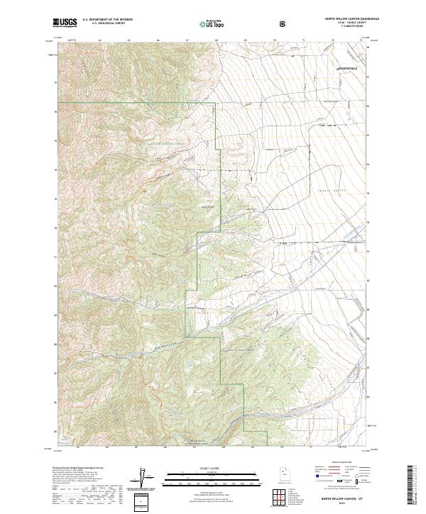
2023 North Willow Canyon
Tooele County, UT
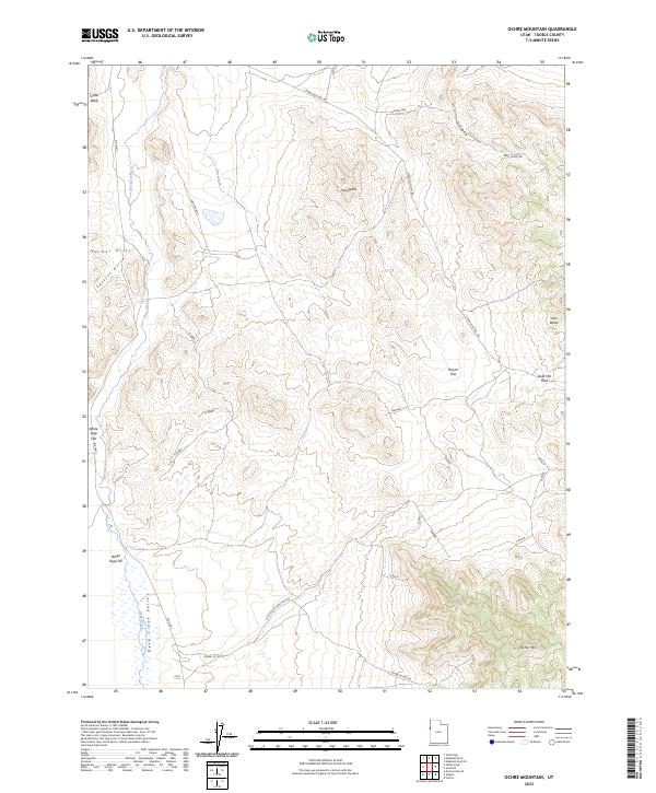
2023 Ochre Mountain
Tooele County, UT
2023 Onaqui Mountains South
Tooele County, UT
2023 Plug Peak NW
Tooele County, UT

2023 Plug Peak SE
Tooele County, UT

2023 Plug Peak
Tooele County, UT
2023 Poverty Point
Tooele County, UT
2023 Puddle Valley Knolls
Tooele County, UT
2023 Quincy Spring
Tooele County, UT
2023 Ripple Valley
Tooele County, UT
2023 Sabie Mountain
Tooele County, UT
2023 Saint John
Tooele County, UT
2023 Salduro SE
Tooele County, UT
2023 Salduro SW
Tooele County, UT
2023 Salduro
Tooele County, UT
2023 Salt Mountain
Tooele County, UT
2023 Silsbee
Tooele County, UT
2023 Silver Island Pass
Tooele County, UT
2023 Simpson Springs
Tooele County, UT
2023 South Mountain
Tooele County, UT
2023 South of Arinosa SE
Tooele County, UT
2023 South of Arinosa SW
Tooele County, UT
2023 South of Big Pass
Tooele County, UT
2023 South of Keller Well
Tooele County, UT
2023 Tabbys Peak SE
Tooele County, UT
2023 Tabbys Peak SW
Tooele County, UT
2023 Tabbys Peak
Tooele County, UT
2023 Table Mountain
Tooele County, UT

2023 Terra
Tooele County, UT
2023 Tetzlaff Peak
Tooele County, UT
2023 Timpie
Tooele County, UT
2023 Utah Peak
Tooele County, UT
2023 Vernon NE
Tooele County, UT
2023 West of Wildcat Mountain SW
Tooele County, UT
2023 Wig Mountain NE
Tooele County, UT
2023 Wig Mountain NW
Tooele County, UT
2023 Wig Mountain SW
Tooele County, UT
2023 Wig Mountain
Tooele County, UT
2023 Wildcat Mountain NW
Tooele County, UT
2023 Wildcat Mountain SE
Tooele County, UT
2023 Wildcat Mountain SW
Tooele County, UT
2023 Wildcat Mountain
Tooele County, UT