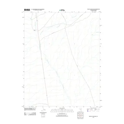
2012 Map of Wildcat Wash NW
USGS Topo · Published 2012About this map
Butler Ranch and a network of desert water sources define this high-desert region of Lincoln County. The landscape is dominated by the convergence of several major drainages, including Pahranagat Wash and the expansive Kane Springs Wash. These natural corridors historically dictated the movement of people and livestock across the arid terrain. Transportation in the early 21st century relied on both modern infrastructure and the remnants of the past, with Old Hwy 93 and Kane Springs Rd providing access to the interior. Springs such as Coyote Spring, Lamb Spring, and Granger Spring represent the critical, localized water points essential for life and ranching in this remote section of Nevada.
Find a feature on this map
8 named features on this map. Tap any name to fly to it.
Don’t see what you’re looking for? This feature index may not catch every label — zoom into the map to look around manually.
Map Details
Editions of this 2012 Wildcat Wash NW Map
This is the sole edition of this map. No revisions or reprints were ever made.
Other maps of this area

1885 · Pioche
USGS Topo · 1:250,000

1886 · Saint Thomas
USGS Topo · 1:250,000

1886 · Pioche
USGS Topo · 1:250,000

1893 · Saint Thomas
USGS Topo · 1:250,000

1907 · Las Vegas
USGS Topo · 1:250,000

1908 · Las Vegas
USGS Topo · 1:250,000

1945 · Sheep Range
USGS Topo · 1:125,000

1945 · Alamo
USGS Topo · 1:125,000

1954 · Caliente
USGS Topo · 1:250,000

1954 · Las Vegas
USGS Topo · 1:250,000