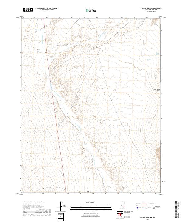
2021 Map of Wildcat Wash NW
USGS Topo · Published 2021About this map
Coyote Spring Valley defines the landscape of this Lincoln County region, where seasonal watercourses and essential desert springs dictate the patterns of human and animal movement. The drainage of Pahranagat Wash cuts through the center of the sheet, joined by Kane Springs Wash as they navigate the arid terrain. These hydrologic features are the lifeblood of the area, supporting established water points such as Coyote Spring, Lamb Spring, and Granger Spring.
Find a feature on this map
11 named features on this map. Tap any name to fly to it.
Don’t see what you’re looking for? This feature index may not catch every label — zoom into the map to look around manually.
Map Details
Editions of this 2021 Wildcat Wash NW Map
This is the sole edition of this map. No revisions or reprints were ever made.
Other maps of this area

1885 · Pioche
USGS Topo · 1:250,000

1886 · Saint Thomas
USGS Topo · 1:250,000

1886 · Pioche
USGS Topo · 1:250,000

1893 · Saint Thomas
USGS Topo · 1:250,000

1907 · Las Vegas
USGS Topo · 1:250,000

1908 · Las Vegas
USGS Topo · 1:250,000

1945 · Sheep Range
USGS Topo · 1:125,000

1945 · Alamo
USGS Topo · 1:125,000

1954 · Caliente
USGS Topo · 1:250,000

1954 · Las Vegas
USGS Topo · 1:250,000