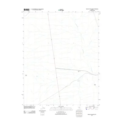
2012 Map of Wildcat Wash SW
USGS Topo · Published 2012About this map
Pahranagat Wash meanders through this arid landscape, carving a primary drainage route north of the Elbow Range. The presence of Perkins Spring and the Perkins Number One Reservoir indicates the critical importance of water management for local ranching or land use in this part of Clark County. To the east, Starvation Flat provides a starkly named contrast to the drainage of Double Canyon, while Sawmill Rd cuts across the lower half of the quadrangle, suggesting historical routes for timber or resources moved through these desert corridors. This survey provides a clear view of the topographical transitions between these desert sinks and upland features during the early 21st century.
Find a feature on this map
7 named features on this map. Tap any name to fly to it.
Don’t see what you’re looking for? This feature index may not catch every label — zoom into the map to look around manually.
Map Details
Editions of this 2012 Wildcat Wash SW Map
This is the sole edition of this map. No revisions or reprints were ever made.
Other maps of this area

1886 · Saint Thomas
USGS Topo · 1:250,000

1893 · Saint Thomas
USGS Topo · 1:250,000

1907 · Las Vegas
USGS Topo · 1:250,000

1908 · Las Vegas
USGS Topo · 1:250,000

1945 · Sheep Range
USGS Topo · 1:125,000

1954 · Las Vegas
USGS Topo · 1:250,000

1957 · Las Vegas
USGS Topo · 1:250,000

1958 · Arrow Canyon
USGS Topo · 1:62,500

1959 · Las Vegas
USGS Topo · 1:250,000

1960 · Hayford Peak
USGS Topo · 1:62,500