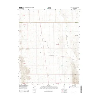
2014 Map of Wildcat Wash SW
USGS Topo · Published 2014About this map
Coyote Spring Valley dominates this high-desert landscape in southern Nevada, where the drainage of the Pahranagat Wash cuts through the arid basins of Clark and Lincoln Counties. The terrain is defined by the sharp elevations of the Arrow Canyon Range to the east and the Elbow Range to the west, framing the broad expanse of Starvation Flat. Water, the region's most precious resource, is marked by isolated points like Perkins Spring and the Perkins Number One Reservoir. This survey shows a transition in land use, featuring long-established routes like Mormon Well Rd alongside modern thoroughfares including Coyote Springs Pkwy and Lake House Ave, indicating recent development within the valley. The map also clearly delineates the Lincoln Co Clark Co boundary as it bisects the northern reaches of the valley.
Find a feature on this map
20 named features on this map. Tap any name to fly to it.
Don’t see what you’re looking for? This feature index may not catch every label — zoom into the map to look around manually.
Map Details
Editions of this 2014 Wildcat Wash SW Map
This is the sole edition of this map. No revisions or reprints were ever made.
Other maps of this area

1886 · Saint Thomas
USGS Topo · 1:250,000

1893 · Saint Thomas
USGS Topo · 1:250,000

1907 · Las Vegas
USGS Topo · 1:250,000

1908 · Las Vegas
USGS Topo · 1:250,000

1945 · Sheep Range
USGS Topo · 1:125,000

1954 · Las Vegas
USGS Topo · 1:250,000

1957 · Las Vegas
USGS Topo · 1:250,000

1958 · Arrow Canyon
USGS Topo · 1:62,500

1959 · Las Vegas
USGS Topo · 1:250,000

1960 · Hayford Peak
USGS Topo · 1:62,500