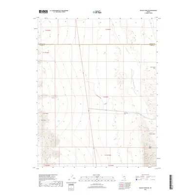
2018 Map of Wildcat Wash SW
USGS Topo · Published 2018About this map
Pahranagat Wash defines the drainage pattern of this high-desert landscape on the border of Lincoln and Clark counties. The terrain is characterized by the expansive Coyote Spring Valley and the dry reaches of Starvation Flat, where topographic relief is provided by the Elbow Range to the west and the Arrow Canyon Range in the southeast. While the landscape is largely dominated by open basin and range geography, the presence of Perkins Spring suggests a rare water source in an otherwise arid environment. Modern infrastructure is beginning to mark the area, indicated by the corridors of Coyote Springs Pkwy and the more primitive Bear Trl. The map illustrates the intersection of traditional desert landmarks like Double Canyon with the structured township and range grid lines that define Nevada's land management.
Find a feature on this map
18 named features on this map. Tap any name to fly to it.
Don’t see what you’re looking for? This feature index may not catch every label — zoom into the map to look around manually.
Map Details
Editions of this 2018 Wildcat Wash SW Map
This is the sole edition of this map. No revisions or reprints were ever made.
Other maps of this area

1886 · Saint Thomas
USGS Topo · 1:250,000

1893 · Saint Thomas
USGS Topo · 1:250,000

1907 · Las Vegas
USGS Topo · 1:250,000

1908 · Las Vegas
USGS Topo · 1:250,000

1945 · Sheep Range
USGS Topo · 1:125,000

1954 · Las Vegas
USGS Topo · 1:250,000

1957 · Las Vegas
USGS Topo · 1:250,000

1958 · Arrow Canyon
USGS Topo · 1:62,500

1959 · Las Vegas
USGS Topo · 1:250,000

1960 · Hayford Peak
USGS Topo · 1:62,500