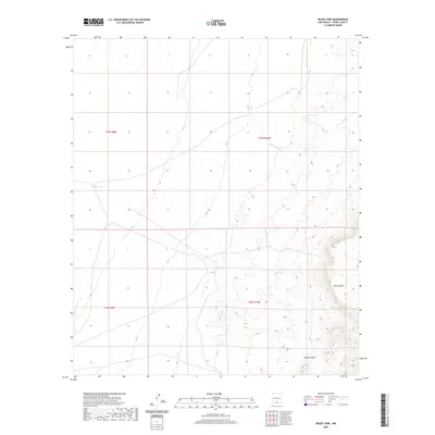
2020 Map of Wilde Tank
USGS Topo · Published 2020About this map
Otero Mesa defines the high desert topography of this southwestern landscape, where the rising terrain of the eastern portion contrasts with the flatter plains to the west. Water management is a central theme in this arid environment, evidenced by Wilde Tank, a critical catchment point for local resources. The natural drainage of the land is shaped by features like Rough Canyon and Pendejo Wash, which channel seasonal flows through the basin. These geological markers suggest a landscape primarily utilized for grazing or resource management, where specific water sources and terrain changes dictate the utility of the land within the Public Land Survey System grids of t21s r9e and t22s r10e.
Find a feature on this map
8 named features on this map. Tap any name to fly to it.
Don’t see what you’re looking for? This feature index may not catch every label — zoom into the map to look around manually.
Map Details
Editions of this 2020 Wilde Tank Map
This is the sole edition of this map. No revisions or reprints were ever made.
Other maps of this area

1916 · Point Of Sands
USGS Topo · 1:125,000

1940 · Orogrande
USGS Topo · 1:62,500

1943 · Pendejo Wash
USGS Topo · 1:62,500

1943 · Orogrande
USGS Topo · 1:62,500

1947 · Orogrande North
USGS Topo · 1:24,000
1948 · Orogrande South
USGS Topo · 1:24,000

1948 · Tres Hermanos
USGS Topo · 1:62,500

1950 · Escondido Canyon
USGS Topo · 1:62,500

1954 · Carlsbad
USGS Topo · 1:250,000
1955 · Orogrande South
USGS Topo · 1:24,000