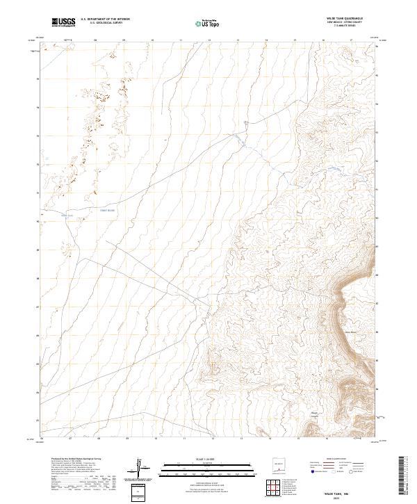
2023 Map of Wilde Tank
USGS Topo · Published 2023About this map
Fort Bliss dominates the landscape of this high desert region in southern New Mexico, marking a significant military presence within Otero County. The terrain is characterized by the expansive Otero Mesa, where drainage patterns like Pendejo Wash and the steep cut of Rough Canyon define the arid topography. This 2023 survey illustrates a landscape primarily shaped by military use and essential water infrastructure, such as Wilde Tank, which serves as a critical point in an otherwise dry environment. The mapping of this area focuses on these foundational geographical and jurisdictional markers, reflecting the intersection of federal land management and the natural desert environment.
Find a feature on this map
9 named features on this map. Tap any name to fly to it.
Don’t see what you’re looking for? This feature index may not catch every label — zoom into the map to look around manually.
Map Details
Editions of this 2023 Wilde Tank Map
This is the sole edition of this map. No revisions or reprints were ever made.
Other maps of this area

1916 · Point Of Sands
USGS Topo · 1:125,000

1940 · Orogrande
USGS Topo · 1:62,500

1943 · Pendejo Wash
USGS Topo · 1:62,500

1943 · Orogrande
USGS Topo · 1:62,500

1947 · Orogrande North
USGS Topo · 1:24,000
1948 · Orogrande South
USGS Topo · 1:24,000

1948 · Tres Hermanos
USGS Topo · 1:62,500

1950 · Escondido Canyon
USGS Topo · 1:62,500

1954 · Carlsbad
USGS Topo · 1:250,000
1955 · Orogrande South
USGS Topo · 1:24,000