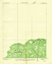
1935 Map of Wilder
USGS Topo · Published 1935About this map
Wilder and its surrounding mountain hollows appear here as documented in the mid-1930s by the Tennessee Valley Authority and the Geological Survey. The settlement pattern is deeply tied to the coal and timber transport needs of the Clinchfield railroad, which snakes through the southern portion of the quadrangle along the creek beds. This advance sheet captures a network of small mountain communities and ridge-top homesteads connected by a system of roads and trails like Roll.
Find a feature on this map
40 named features on this map. Tap any name to fly to it.
Don’t see what you’re looking for? This feature index may not catch every label — zoom into the map to look around manually.
Map Details
Editions of this 1935 Wilder Map
This is the sole edition of this map. No revisions or reprints were ever made.
Other maps of this area

1886 · Grundy
USGS Topo · 1:125,000

1890 · Grundy
USGS Topo · 1:125,000

1892 · Grundy
USGS Topo · 1:125,000

1897 · Bristol
USGS Topo · 1:125,000

1902 · Bristol
USGS Topo · 1:125,000

1913 · Clintwood
USGS Topo · 1:62,500

1914 · Bucu
USGS Topo · 1:48,000

1915 · Clintwood
USGS Topo · 1:62,500

1916 · Bucu
USGS Topo · 1:62,500

1918 · Carterton
USGS Topo · 1:62,500