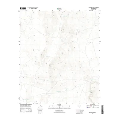
2016 Map of Wildhorse Draw
USGS Topo · Published 2016About this map
Wildhorse Draw and Borrego Draw anchor this high-desert landscape in Hudspeth County, where the management of water is the primary human footprint on the land. This 2016 survey illustrates a network of essential water catchments, including family or locally named features such as Crowder Tank, Peacock Tank, and Monroe Tank. The terrain is defined by the gradual descent of drainages toward the south and west, with Peacock Canyon cutting through the eastern elevations. The presence of Old Rattlesnake Tank near the newer Rattlesnake Tank suggests a shift in livestock management or water infrastructure over time. Unlike more populated regions, the map is remarkably sparse of buildings or roads, focusing instead on the topographic nuances of the Trans-Pecos region and the named tanks that support life in this arid environment.
Find a feature on this map
14 named features on this map. Tap any name to fly to it.
Don’t see what you’re looking for? This feature index may not catch every label — zoom into the map to look around manually.
Map Details
Editions of this 2016 Wildhorse Draw Map
This is the sole edition of this map. No revisions or reprints were ever made.
Other maps of this area

1903 · Cerro Alto
USGS Topo · 1:125,000

1941 · Heuco Mountains
USGS Topo · 1:62,500

1942 · Borrego
USGS Topo · 1:62,500

1943 · Tepee Butte
USGS Topo · 1:62,500

1943 · San Antonio Mtn
USGS Topo · 1:62,500

1943 · Heuco Mountains
USGS Topo · 1:62,500

1954 · Van Horn
USGS Topo · 1:250,000

1958 · Van Horn
USGS Topo · 1:250,000
1977 · Whiterock Hills
USGS Topo · 1:24,000
1978 · Wildhorse Draw
USGS Topo · 1:24,000