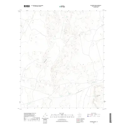
2019 Map of Wildhorse Draw
USGS Topo · Published 2019About this map
Wildhorse Draw and Borrego Draw define the drainage patterns of this arid Hudspeth County landscape. In this modern survey, the topography is punctuated by numerous artificial watering points essential for ranching in the Trans-Pecos region. These features, such as Old Rattlesnake Tank and Monroe Tank, reflect the vital infrastructure required to support livestock across the desert floor.
Find a feature on this map
14 named features on this map. Tap any name to fly to it.
Don’t see what you’re looking for? This feature index may not catch every label — zoom into the map to look around manually.
Map Details
Editions of this 2019 Wildhorse Draw Map
This is the sole edition of this map. No revisions or reprints were ever made.
Other maps of this area

1903 · Cerro Alto
USGS Topo · 1:125,000

1941 · Heuco Mountains
USGS Topo · 1:62,500

1942 · Borrego
USGS Topo · 1:62,500

1943 · Tepee Butte
USGS Topo · 1:62,500

1943 · San Antonio Mtn
USGS Topo · 1:62,500

1943 · Heuco Mountains
USGS Topo · 1:62,500

1954 · Van Horn
USGS Topo · 1:250,000

1958 · Van Horn
USGS Topo · 1:250,000
1977 · Whiterock Hills
USGS Topo · 1:24,000
1978 · Wildhorse Draw
USGS Topo · 1:24,000