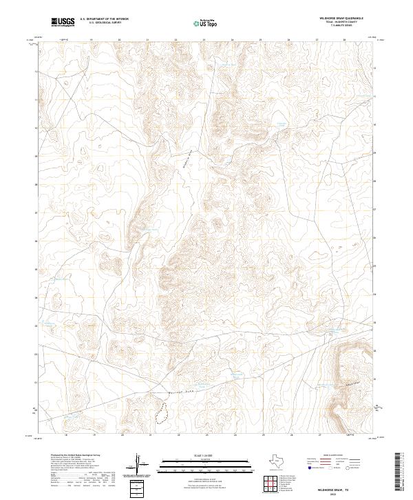
2022 Map of Wildhorse Draw
USGS Topo · Published 2022About this map
Wildhorse Draw and Borrego Draw define the drainage patterns of this arid Hudspeth County landscape. This 2022 survey illustrates the vital importance of water management in West Texas, evidenced by a dense network of man-made catchment features including Monroe Tank, Antelope Tank, and Shakespeare Tanks. These features are often the only reliable water sources for local livestock and wildlife in the high desert terrain. The topography is further shaped by Peacock Canyon in the southeast, while family-named or descriptive landmarks like Peacock Tank and Old Rattlesnake Tank provide essential navigational points for researchers of local land use and ranching history.
Find a feature on this map
14 named features on this map. Tap any name to fly to it.
Don’t see what you’re looking for? This feature index may not catch every label — zoom into the map to look around manually.
Map Details
Editions of this 2022 Wildhorse Draw Map
This is the sole edition of this map. No revisions or reprints were ever made.
Other maps of this area

1903 · Cerro Alto
USGS Topo · 1:125,000

1941 · Heuco Mountains
USGS Topo · 1:62,500

1942 · Borrego
USGS Topo · 1:62,500

1943 · Tepee Butte
USGS Topo · 1:62,500

1943 · San Antonio Mtn
USGS Topo · 1:62,500

1943 · Heuco Mountains
USGS Topo · 1:62,500

1954 · Van Horn
USGS Topo · 1:250,000

1958 · Van Horn
USGS Topo · 1:250,000
1977 · Whiterock Hills
USGS Topo · 1:24,000
1978 · Wildhorse Draw
USGS Topo · 1:24,000