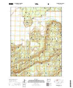
2020 Map of Wildhorse Ridge
USGS Topo · Published 2020About this map
Klamath Marsh National Wildlife Refuge dominates the western portion of this 2020 topographic survey, showcasing a complex hydrology of natural watercourses and man-made infrastructure. The Williamson River winds through the wetlands, supplemented by the Kittredge Canal and Williamson River Ditch, indicating a landscape managed for both wildlife conservation and water distribution. To the east, the terrain rises into the timbered reaches of the Winema National Forest, where high ground is marked by the volcanic profile of Wildhorse Ridge and the elongated depression of Skellock Draw. Distinctive local landmarks such as Hog Island, Bloody Point, and Sagebrush Point rise above the marshy lowlands, providing critical orientation points in the vast basin. Isolated water sources like Bluejay Spring and South Fork Spring punctuate the drier forest slopes, reflecting the vital role of groundwater in this high-desert ecosystem.
Find a feature on this map
25 named features on this map. Tap any name to fly to it.
Don’t see what you’re looking for? This feature index may not catch every label — zoom into the map to look around manually.
Map Details
Editions of this 2020 Wildhorse Ridge Map
This is the sole edition of this map. No revisions or reprints were ever made.
Other maps of this area

1889 · Klamath
USGS Topo · 1:250,000

1894 · Klamath
USGS Topo · 1:250,000

1935 · Chemult
USGS Topo · 1:96,000

1941 · Chemult
USGS Topo · 1:125,000

1955 · Crescent
USGS Topo · 1:250,000

1955 · Klamath Falls
USGS Topo · 1:250,000

1957 · Crescent
USGS Topo · 1:250,000

1957 · Klamath Marsh
USGS Topo · 1:62,500

1958 · Crescent
USGS Topo · 1:250,000

1958 · Klamath Falls
USGS Topo · 1:250,000