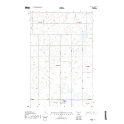
2017 Map of Wildrose
USGS Topo · Published 2017About this map
Wildrose sits at the southern edge of this West North Dakota landscape, positioned along the border where Divide and Williams counties meet. The town's grid is centered on Main St and Railroad Ave, reflecting its history as a prairie rail point. Just west of the town site, Grace Cem serves as a significant landmark for genealogical research. The surrounding terrain is characterized by a high concentration of prairie potholes and wetlands, including Big Slough, Thorsons Lake, and Willow Lake. The extensive presence of ephemeral water bodies like The Swamp and Rosten Slough illustrates the complex drainage and agricultural environment typical of the Missouri Coteau region. A dense network of section-line roads, such as Co Rd 17 and 84th St NW, connects the scattered farms across this rural territory.
Find a feature on this map
41 named features on this map. Tap any name to fly to it.
Don’t see what you’re looking for? This feature index may not catch every label — zoom into the map to look around manually.
Map Details
Editions of this 2017 Wildrose Map
This is the sole edition of this map. No revisions or reprints were ever made.
Other maps of this area

1948 · Alamo N.E.
USGS Topo · 1:24,000

1948 · Crosby SE
USGS Topo · 1:24,000

1949 · Noonan SW
USGS Topo · 1:24,000

1949 · Noonan SE
USGS Topo · 1:24,000

1950 · Crosby
USGS Topo · 1:62,500

1950 · Noonan
USGS Topo · 1:62,500

1953 · Williston
USGS Topo · 1:250,000

1957 · Williston
USGS Topo · 1:250,000

1974 · Wildrose
USGS Topo · 1:24,000

1974 · Tom Berg Lake
USGS Topo · 1:24,000