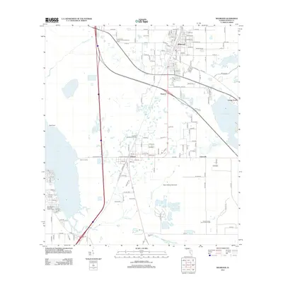
2012 Map of Wildwood
USGS Topo · Published 2012About this map
Wildwood and its surroundings in Sumter County are defined by a complex intersection of transportation and wetland hydrology. The town's grid, featuring streets like Cleveland Ave and Missouri Ave, serves as a local hub near the United States Forestry Lookout Wildwood Tower. The movement of water through this landscape is evident in features like the expansive Evans Prairie, Lake Okahumpka, and the northern reaches of Lake Panasoffkee near Coleman Landing. To the south, the Coleman Federal Correctional Complex occupies a significant portion of the terrain between Coleman and the Sumterville Cem. The path of CSX Transportation through Monarch and Adamsville underscores the area's rail-dependent history, while local aviation is represented by Freeflight International Airport and Montgomery's Flying M Ranch Airport.
Find a feature on this map
73 named features on this map. Tap any name to fly to it.
Don’t see what you’re looking for? This feature index may not catch every label — zoom into the map to look around manually.
Map Details
Editions of this 2012 Wildwood Map
This is the sole edition of this map. No revisions or reprints were ever made.
Other maps of this area

1893 · Panasoffkee
USGS Topo · 1:62,500

1895 · Panasoffkee
USGS Topo · 1:62,500

1955 · Plant City
USGS Topo · 1:250,000

1955 · Orlando
USGS Topo · 1:250,000

1957 · Orlando
USGS Topo · 1:250,000

1958 · Orlando
USGS Topo · 1:250,000

1958 · Plant City
USGS Topo · 1:250,000

1958 · Bushnell
USGS Topo · 1:24,000

1958 · Wahoo
USGS Topo · 1:24,000

1959 · Plant City
USGS Topo · 1:250,000