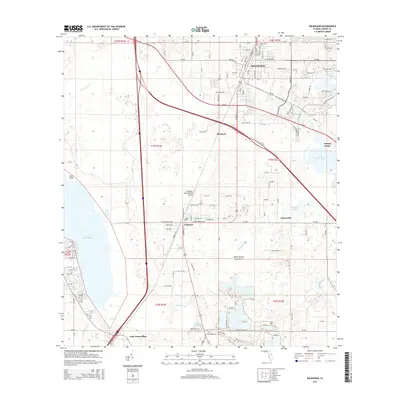
2015 Map of Wildwood
USGS Topo · Published 2015About this map
Wildwood serves as a central hub in this Sumter County landscape, where the CSX rail corridor and major thoroughfares like SR-44 converge. The settlement pattern shows a mix of established residential grids and newer developments expanding toward Evans Prairie and Lake Okahumpka. To the south, the community of Coleman sits along the rail line, while smaller locales like Adamsville and Monarch dot the interior.
Find a feature on this map
130 named features on this map. Tap any name to fly to it.
Don’t see what you’re looking for? This feature index may not catch every label — zoom into the map to look around manually.
Map Details
Editions of this 2015 Wildwood Map
This is the sole edition of this map. No revisions or reprints were ever made.
Other maps of this area

1893 · Panasoffkee
USGS Topo · 1:62,500

1895 · Panasoffkee
USGS Topo · 1:62,500

1955 · Plant City
USGS Topo · 1:250,000

1955 · Orlando
USGS Topo · 1:250,000

1957 · Orlando
USGS Topo · 1:250,000

1958 · Orlando
USGS Topo · 1:250,000

1958 · Plant City
USGS Topo · 1:250,000

1958 · Bushnell
USGS Topo · 1:24,000

1958 · Wahoo
USGS Topo · 1:24,000

1959 · Plant City
USGS Topo · 1:250,000