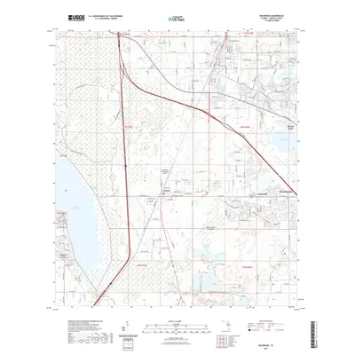
2021 Map of Wildwood
USGS Topo · Published 2021About this map
Wildwood and the neighboring settlements of Coleman and Adamsville anchor this 2021 landscape in Sumter County, Florida. The map illustrates a region defined by its complex hydrology, where the large expanse of Lake Panasoffkee and Lake Okahumpka dominate the western and eastern boundaries. The drainage of Shady Brook and Little Jones Cr feeds into these larger water bodies, creating a wetland-heavy environment that has shaped local development patterns for generations.
Find a feature on this map
162 named features on this map. Tap any name to fly to it.
Don’t see what you’re looking for? This feature index may not catch every label — zoom into the map to look around manually.
Map Details
Editions of this 2021 Wildwood Map
This is the sole edition of this map. No revisions or reprints were ever made.
Other maps of this area

1893 · Panasoffkee
USGS Topo · 1:62,500

1895 · Panasoffkee
USGS Topo · 1:62,500

1955 · Plant City
USGS Topo · 1:250,000

1955 · Orlando
USGS Topo · 1:250,000

1957 · Orlando
USGS Topo · 1:250,000

1958 · Orlando
USGS Topo · 1:250,000

1958 · Plant City
USGS Topo · 1:250,000

1958 · Bushnell
USGS Topo · 1:24,000

1958 · Wahoo
USGS Topo · 1:24,000

1959 · Plant City
USGS Topo · 1:250,000