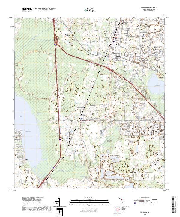
2024 Map of Wildwood
USGS Topo · Published 2024About this map
Wildwood serves as a central hub in this modern survey of Sumter County, where established town centers like Coleman and Adamsville meet the rapid residential expansion of The Villages. The landscape is defined by its diverse water features and wetlands, ranging from the broad eastern shore of Lake Panasoffkee and Old Store Bayou to the managed waters of Beltons Millpond. Natural landmarks like Warm Spring Hammock and the distinctive Hogeye Sink sit alongside a dense network of local trails and residential paths such as Spanish Moss Way and Zebra Longwing Path. Genealogists and local historians can locate several key burial grounds, including Oak Grove Cem, Greenwood Cem, and Sumterville Cem, which provide anchors for the area's long-standing community heritage amidst the evolving suburban layout of central Florida.
Find a feature on this map
96 named features on this map. Tap any name to fly to it.
Don’t see what you’re looking for? This feature index may not catch every label — zoom into the map to look around manually.
Map Details
Editions of this 2024 Wildwood Map
This is the sole edition of this map. No revisions or reprints were ever made.
Other maps of this area

1893 · Panasoffkee
USGS Topo · 1:62,500

1895 · Panasoffkee
USGS Topo · 1:62,500

1955 · Plant City
USGS Topo · 1:250,000

1955 · Orlando
USGS Topo · 1:250,000

1957 · Orlando
USGS Topo · 1:250,000

1958 · Orlando
USGS Topo · 1:250,000

1958 · Plant City
USGS Topo · 1:250,000

1958 · Bushnell
USGS Topo · 1:24,000

1958 · Wahoo
USGS Topo · 1:24,000

1959 · Plant City
USGS Topo · 1:250,000