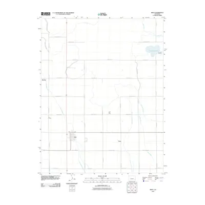
2010 Map of Wiley
USGS Topo · Published 2010About this map
Agricultural life in Prowers County revolves around a sophisticated network of irrigation and drainage that has transformed the arid landscape. The town of Wiley serves as a central hub, flanked by the smaller settlements of Big Bend and Sugar. This 2010 survey highlights the critical role of water management in the region, featuring major conduits like the Satanta Canal and the Pawnee Canal, which feed into local agricultural infrastructure. The presence of the Wiley Drainage Ditch and the Pleasant Valley Drainage Ditch underscores the effort to regulate water flow across the flat terrain. Beyond the grid of county roads, local landmarks such as the Cactus View School and Wiley Cemetery provide anchor points for genealogists and local historians, while the Thurston Reservoir and its associated Thurston Lake Dam represent significant water storage for the community's needs.
Find a feature on this map
34 named features on this map. Tap any name to fly to it.
Don’t see what you’re looking for? This feature index may not catch every label — zoom into the map to look around manually.
Map Details
Editions of this 2010 Wiley Map
This is the sole edition of this map. No revisions or reprints were ever made.
Other maps of this area

1892 · Lamar
USGS Topo · 1:125,000

1952 · Lamar West
USGS Topo · 1:24,000

1953 · Lamar East
USGS Topo · 1:24,000

1953 · Prowers
USGS Topo · 1:24,000

1954 · Lamar
USGS Topo · 1:250,000

1955 · McClave
USGS Topo · 1:24,000

1955 · May Valley
USGS Topo · 1:24,000

1955 · Wiley
USGS Topo · 1:24,000

1958 · Lamar
USGS Topo · 1:250,000

1967 · Neenoshe Reservoir
USGS Topo · 1:24,000