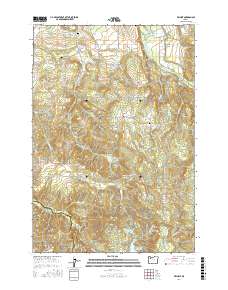
2017 Map of Wilhoit
USGS Topo · Published 2017About this map
Wilhoit Mineral Springs and the surrounding settlement of Wilhoit anchor this portion of the Cascade foothills, where the Clackamas Co and Marion Co line meets. The landscape is defined by a dense network of timber access roads and small-scale water management, including the Beaver Reservoir and Deardorff Reservoir. Geologic and topographic points of interest like the Punchbowl and Missouri Ridge rise above the drainage basins of Thomas Cr and the Molalla River. Family history and early land use are evident in several remote burial sites, such as Dart Cem and Russellville Cem, which remain tucked away from the more developed valley floors. The transition from the flat agricultural lands of Dickey Prairie to the steep, wooded terrain of High Hill illustrates the shift into the higher wilderness characteristic of north-central Oregon.
Find a feature on this map
79 named features on this map. Tap any name to fly to it.
Don’t see what you’re looking for? This feature index may not catch every label — zoom into the map to look around manually.
Map Details
Editions of this 2017 Wilhoit Map
This is the sole edition of this map. No revisions or reprints were ever made.
Other maps of this area

1916 · Estacada
USGS Topo · 1:125,000

1929 · Mill City
USGS Topo · 1:125,000

1939 · Molalla
USGS Topo · 1:62,500

1940 · Molalla
USGS Topo · 1:62,500

1948 · Vancouver
USGS Topo · 1:250,000

1950 · Vancouver
USGS Topo · 1:250,000

1950 · Vancouver
USGS Topo · 1:250,000

1951 · Lyons
USGS Topo · 1:62,500

1953 · Salem
USGS Topo · 1:250,000

1954 · Salem
USGS Topo · 1:250,000