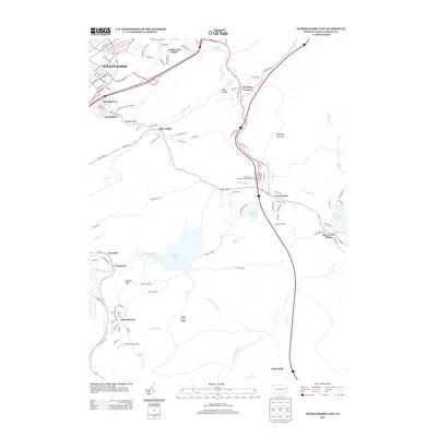
2013 Map of Wilkes-Barre East
USGS Topo · Published 2013About this map
Wilkes-Barre anchors the northwestern corner of this map, showcasing the dense residential and commercial expansion that characterizes the area during the early 21st century. The terrain transitions sharply from the city’s streets, like Coal St and Highland Park Blvd, into the elevations of Wyoming Mountain. This landscape is defined by its complex hydrology and small, isolated settlements that reflect older industrial and recreational patterns. Localities such as Oliver Mills and Ochre Mill point to the historic importance of water power along the area's numerous runs and creeks. To the south, Glen Summit and Bear Creek Village sit among significant water bodies like Crystal Lake and Bear Creek Lake. This 2013 survey provides a clear view of the modern transportation infrastructure, including the Pennsylvania Turnpike Interchange 36 and the small Rosenzweig Airport.
Find a feature on this map
112 named features on this map. Tap any name to fly to it.
Don’t see what you’re looking for? This feature index may not catch every label — zoom into the map to look around manually.
Map Details
Editions of this 2013 Wilkes-Barre East Map
This is the sole edition of this map. No revisions or reprints were ever made.
Other maps of this area

1889 · Scranton
USGS Topo · 1:62,500

1891 · Wilkesbarre
USGS Topo · 1:62,500

1891 · Scranton
USGS Topo · 1:62,500

1893 · Pittston
USGS Topo · 1:62,500

1893 · Scranton
USGS Topo · 1:62,500

1894 · Wilkesbarre
USGS Topo · 1:62,500

1922 · Stoddartsville
USGS Topo · 1:62,500

1924 · Stoddartsville
USGS Topo · 1:62,500

1943 · Scranton
USGS Topo · 1:125,000

1943 · Stoddartsville
USGS Topo · 1:62,500