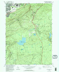
1994 Map of Wilkes-Barre East
USGS Topo · Published 1995About this map
Wilkes-Barre sits at the foot of the massive Wilkes-Barre Mountain ridge, where urban development abruptly meets the vast, protected woodlands of the Commonwealth. This landscape is defined by the sharp transition from the valley's industrial and commercial core, featuring the Wyoming Valley Mall Shopping Center and the VA Medical Center, to the high-elevation swamps and peaks of the Pocono plateau. Historically, the area south of the ridge was a retreat for the region's elite, evidenced by the clustered summer homes and recreational sites around Crystal Lake and the settlement of Glen Summit.
Find a feature on this map
71 named features on this map. Tap any name to fly to it.
Don’t see what you’re looking for? This feature index may not catch every label — zoom into the map to look around manually.
Map Details
Editions of this 1994 Wilkes-Barre East Map
This is the sole edition of this map. No revisions or reprints were ever made.
Other maps of this area

1889 · Scranton
USGS Topo · 1:62,500

1891 · Wilkesbarre
USGS Topo · 1:62,500

1891 · Scranton
USGS Topo · 1:62,500

1893 · Pittston
USGS Topo · 1:62,500

1893 · Scranton
USGS Topo · 1:62,500

1894 · Wilkesbarre
USGS Topo · 1:62,500

1922 · Stoddartsville
USGS Topo · 1:62,500

1924 · Stoddartsville
USGS Topo · 1:62,500

1943 · Scranton
USGS Topo · 1:125,000

1943 · Stoddartsville
USGS Topo · 1:62,500