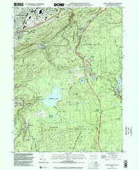
1999 Map of Wilkes-Barre East
USGS Topo · Published 2002About this map
Wilkes-Barre anchors the northwestern corner of this study, where urban development meets the steep ascent of Wilkes-Barre Mountain. The 1999 landscape reveals a clear distinction between the industrial and residential corridors of the valley and the expansive wooded conservation areas to the southeast. Settlements like Bear Creek Village and Glen Summit are nestled among the high peaks, connected by historic routes like the Old Glen Summit Road and the modern Pennsylvania Northeast Extension.
Find a feature on this map
57 named features on this map. Tap any name to fly to it.
Don’t see what you’re looking for? This feature index may not catch every label — zoom into the map to look around manually.
Map Details
Editions of this 1999 Wilkes-Barre East Map
This is the sole edition of this map. No revisions or reprints were ever made.
Other maps of this area

1889 · Scranton
USGS Topo · 1:62,500

1891 · Wilkesbarre
USGS Topo · 1:62,500

1891 · Scranton
USGS Topo · 1:62,500

1893 · Pittston
USGS Topo · 1:62,500

1893 · Scranton
USGS Topo · 1:62,500

1894 · Wilkesbarre
USGS Topo · 1:62,500

1922 · Stoddartsville
USGS Topo · 1:62,500

1924 · Stoddartsville
USGS Topo · 1:62,500

1943 · Scranton
USGS Topo · 1:125,000

1943 · Stoddartsville
USGS Topo · 1:62,500