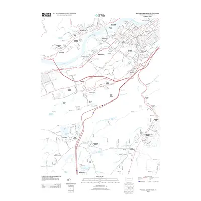
2013 Map of Wilkes-Barre West
USGS Topo · Published 2013About this map
The Susquehanna River flows through this valley landscape, dividing the industrial and residential corridors of Plymouth and Ashley. This region is defined by its densely packed borough settlements and the significant gaps in Wilkes-Barre Mountain, such as Solomon Gap and Warrior Gap. The map details the transition from the riverfront urban centers of Breslau and Lee Park to the higher elevations of Mountain Top and Fairview.
Find a feature on this map
68 named features on this map. Tap any name to fly to it.
Don’t see what you’re looking for? This feature index may not catch every label — zoom into the map to look around manually.
Map Details
Editions of this 2013 Wilkes-Barre West Map
This is the sole edition of this map. No revisions or reprints were ever made.
Other maps of this area

1891 · Wilkesbarre
USGS Topo · 1:62,500

1891 · Harveys Lake
USGS Topo · 1:62,500

1893 · Harvey Lake
USGS Topo · 1:62,500

1893 · Pittston
USGS Topo · 1:62,500

1894 · Shickshinny
USGS Topo · 1:62,500

1894 · Wilkesbarre
USGS Topo · 1:62,500

1943 · Scranton
USGS Topo · 1:125,000

1946 · Sybertsville
USGS Topo · 1:31,680

1946 · Nanticoke
USGS Topo · 1:31,680

1946 · Kingston
USGS Topo · 1:24,000