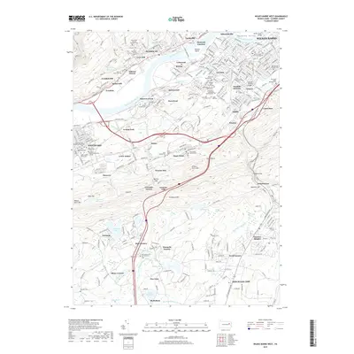
2019 Map of Wilkes-Barre West
USGS Topo · Published 2019About this map
The Susquehanna River carves through the heart of the Wyoming Valley in this survey, anchoring a dense network of industrial-era settlements and cultural landmarks. To the north, the urban core of Wilkes-Barre and Plymouth reveals a storied landscape of education and memory, featuring Wilkes University and an exceptional concentration of ethnic and religious burial grounds such as Saints Peter and Paul Ukrainian Cemetery and Shawnee Cemetery. This region's development is closely tied to its topography, with residential pockets like Lynnwood and Breslau tucked into the river's bends, while the ridges of Wilkes-Barre Mountain and Penobscot Mountain separate the river valley from the southern highlands. To the south, the character shifts toward recreation and natural resources near Nuangola Lake and Lake Blytheburn, showcasing the transition from the bustling streets of Nanticoke to the quieter ridges of Solomon Gap.
Find a feature on this map
108 named features on this map. Tap any name to fly to it.
Don’t see what you’re looking for? This feature index may not catch every label — zoom into the map to look around manually.
Map Details
Editions of this 2019 Wilkes-Barre West Map
This is the sole edition of this map. No revisions or reprints were ever made.
Other maps of this area

1891 · Wilkesbarre
USGS Topo · 1:62,500

1891 · Harveys Lake
USGS Topo · 1:62,500

1893 · Harvey Lake
USGS Topo · 1:62,500

1893 · Pittston
USGS Topo · 1:62,500

1894 · Shickshinny
USGS Topo · 1:62,500

1894 · Wilkesbarre
USGS Topo · 1:62,500

1943 · Scranton
USGS Topo · 1:125,000

1946 · Sybertsville
USGS Topo · 1:31,680

1946 · Nanticoke
USGS Topo · 1:31,680

1946 · Kingston
USGS Topo · 1:24,000