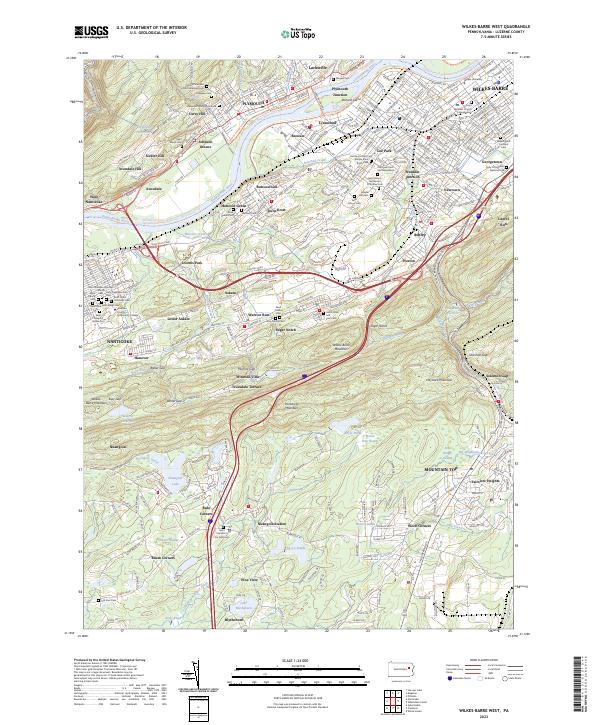
2023 Map of Wilkes-Barre West
USGS Topo · Published 2023About this map
The Susquehanna River carves a dominant path through this corner of Luzerne County, anchoring a landscape where dense urban grids meet the steep elevations of Wilkes-Barre Mountain and Penobscot Mountain. This modern survey details the intricate settlement patterns of the Wyoming Valley, from the industrial heritage of Plymouth Junction and Nanticoke to the residential corridors of Lee Park and Franklin Junction. The area is notably dense with commemorative and religious sites, including the Oak Lawn Cem and Mausoleum and numerous denominational grounds like the Saints Peter and Paul Ukrainian Cem. Educational hubs are prominent here as well, with the campuses of Wilkes University and Luzerne County Community College integrated into the city fabric. South of the river valley, the terrain shifts toward more wooded heights, hiding Nuangola Lake and the wetlands of Beaver Dam Swamp among the ridges.
Find a feature on this map
105 named features on this map. Tap any name to fly to it.
Don’t see what you’re looking for? This feature index may not catch every label — zoom into the map to look around manually.
Map Details
Editions of this 2023 Wilkes-Barre West Map
This is the sole edition of this map. No revisions or reprints were ever made.
Other maps of this area

1891 · Wilkesbarre
USGS Topo · 1:62,500

1891 · Harveys Lake
USGS Topo · 1:62,500

1893 · Harvey Lake
USGS Topo · 1:62,500

1893 · Pittston
USGS Topo · 1:62,500

1894 · Shickshinny
USGS Topo · 1:62,500

1894 · Wilkesbarre
USGS Topo · 1:62,500

1943 · Scranton
USGS Topo · 1:125,000

1946 · Sybertsville
USGS Topo · 1:31,680

1946 · Nanticoke
USGS Topo · 1:31,680

1946 · Kingston
USGS Topo · 1:24,000