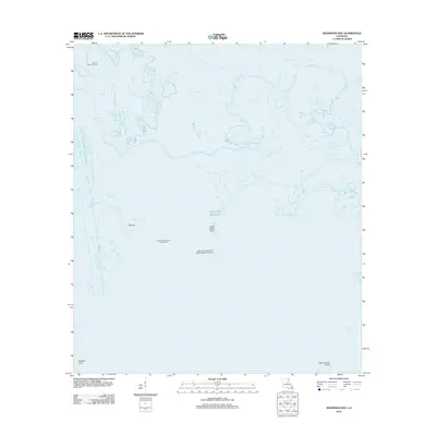
2012 Map of Wilkinson Bay
USGS Topo · Published 2012About this map
Manila Village Oil Field and the nearby Manilla settlement mark a landscape defined by the intersection of industrial extraction and the intricate marshlands of coastal Louisiana. This 2012 survey by the U.S. Geological Survey captures a maritime environment where oil and gas infrastructure is embedded directly into the wetlands. A notable logistics hub is visible at the Saturday Island Tank Battery Seaplane Base, highlighting how transportation in this region relies on aerial and waterborne access rather than traditional roads. The interior is a complex network of water bodies, including Wilkinson Bay and Wilkinson Bayou, which serve as the primary conduits through the marshes. Geographic landmarks such as Saint Marys Point, Milligen Point, and Grand Island Point define the southern reaches where the bayous meet the open waters of the Gulf of Mexico. The map documents the extensive footprint of energy production at the Saturday Island Oil and Gas Field, showing the layout of canals and platforms necessary for coastal resource management.
Find a feature on this map
14 named features on this map. Tap any name to fly to it.
Don’t see what you’re looking for? This feature index may not catch every label — zoom into the map to look around manually.
Map Details
Editions of this 2012 Wilkinson Bay Map
This is the sole edition of this map. No revisions or reprints were ever made.
Other maps of this area

1891 · Pointe a La Hache
USGS Topo · 1:62,500

1892 · Barataria
USGS Topo · 1:62,500

1892 · Creole
USGS Topo · 1:62,500

1892 · Pointe a La Hache
USGS Topo · 1:62,500

1893 · Fort Livingston
USGS Topo · 1:62,500

1935 · Bay Ronquille
USGS Topo · 1:31,680

1935 · Wilkinson Bay
USGS Topo · 1:31,680

1939 · Pointe a La Hache
USGS Topo · 1:62,500

1941 · Barataria
USGS Topo · 1:62,500

1944 · Barataria
USGS Topo · 1:62,500